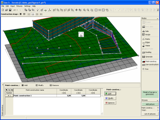
Line Constructions
The frame "Line constructions" serves to introduce line constructions into the terrain.
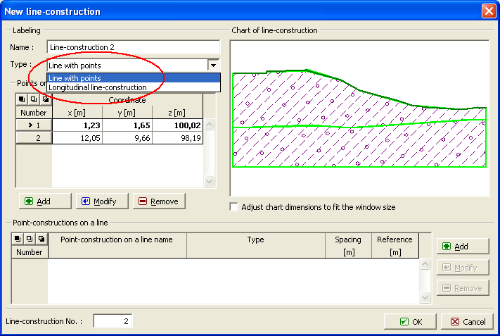
To input lines that determine the location of individual line constructions proceed in the similar way as when defining terrain edges (using either table or mouse). The "New line construction" ("Edit line construction") dialog window allows for specifying the name and type of a construction line:
"Longitudinal line construction" is defined by coordinates of the starting and end points (the table is a part of the dialog window). A combo list serves to select a particular calculation program (Settlement, Slope stability, FEM…). To run the program, use the frame "Launch". Terrain shape and interfaces are transferred in the same way as when assigning soils to layers.
"Line with points" is defined by coordinates of a broken line and can be used to specify new point construction. Point constructions are defined in the table "Point constructions on line", which is a part of the "New line construction" dialog window. The frame "Launching" is then used to run the calculation program and to transfer thicknesses of layers and assignment of soils into the program.
Line constructions can be defined only if a correct model of the terrain is generated.
Visualization of drawing on the desktop can be modified in any input regime based on the setting adjusted in the "Drawing Settings" frame and with the help of buttons on toolbar "Visualization".
 Frame "Line constructions" - input, edit
 Frame "Line constructions" - defined constructions