Modeling Terrain on Edges
A special attention has to be given to boundary condition to correctly create a digital model of terrain - heights of points in corners and boundaries (edges) of the world (world dimensions).
The corner points can be either entered or they are inserted automatically during the first stage of construction. When automatically generated, the corner point receives the same height as the closest point has or borehole already defined.
When generating terrain the corner points are connected by an edge. In some cases (slopes) we wish the edges to model the overall shape and inclination of terrain. In such cases an active edge option can be used. An active edge is introduced as a percentage fraction of the world dimensions. All points found on an active edge are, during generation, automatically projected in the normal direction on to an edge - new points are then created at the same locations (on edge) having the same z-coordinate. The new points are stored in data associated with the next stage of construction.
Subsequent layers of the terrain model behave the same way. The thicknesses of these layers on edges are calculated according to thicknesses of layers of the closest boreholes.
The role of an active edge is evident from the following figure.
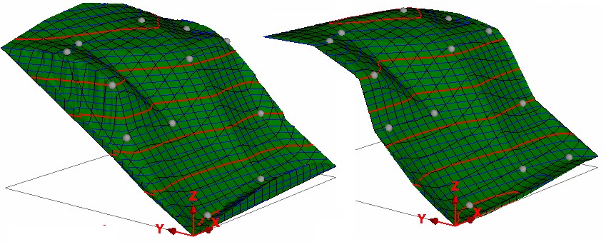 Terrain generated without and with an active edge