Program Point Cloud
The program is designed to process clouds with a large number of points (in the order of hundreds of millions). The main functions include various modifications such as point reduction, cloud cropping, coordinate shifting, or special options such as vegetation removal, etc.
The program can work separately or under the Stratigraphy program. In both cases, we recommend using the 64-bit version for faster work.
- If the program works separately, the result is a point cloud in .las format or point coordinates in .txt format.
- If the program is launched from the "Stratigraphy" program, the result is terrain points that are automatically transferred to the Stratigraphy program and further used to create the construction site.
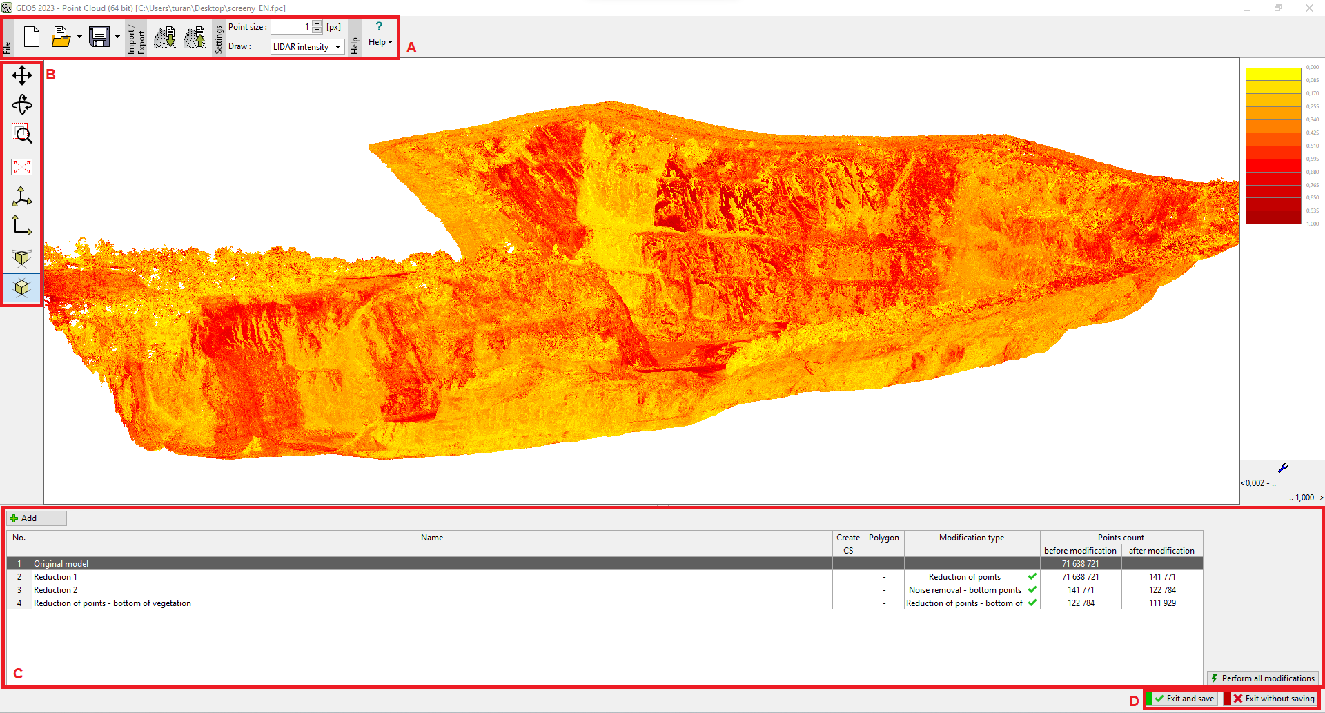
The control of the program is simplified compared to other GEO5 programs, there are no frames on the right side. The program window is divided into three main parts:
- upper toolbar (A) - in addition to basic work with the file, there are also buttons for import/export of data and for setting the display of individual points
- side toolbar (B) - used for visualization settings
- bottom table with individual point cloud modifications (C)
- buttons terminating the program and transferring data (points, construction site, orthophoto) to the "Stratigraphy" program (D) - this part of the window is displayed only if the program is launched under the "Stratigraphy" program
 "Point Cloud" program