Complex Portfolio of Solved Problems
The GEO5 solution includes a set of programs for all types of geotechnical tasks. The programs work together and allow transfer of all input data easily between them.
From Geological Survey to Design
In addition to the design and verification of geotechnical structures, GEO5 also offers complete options for geological survey processing - the data collection in field or laboratory, the creation of geological documentation of the field tests, the compilation of geological cross sections, and the generation of a complex geological model.
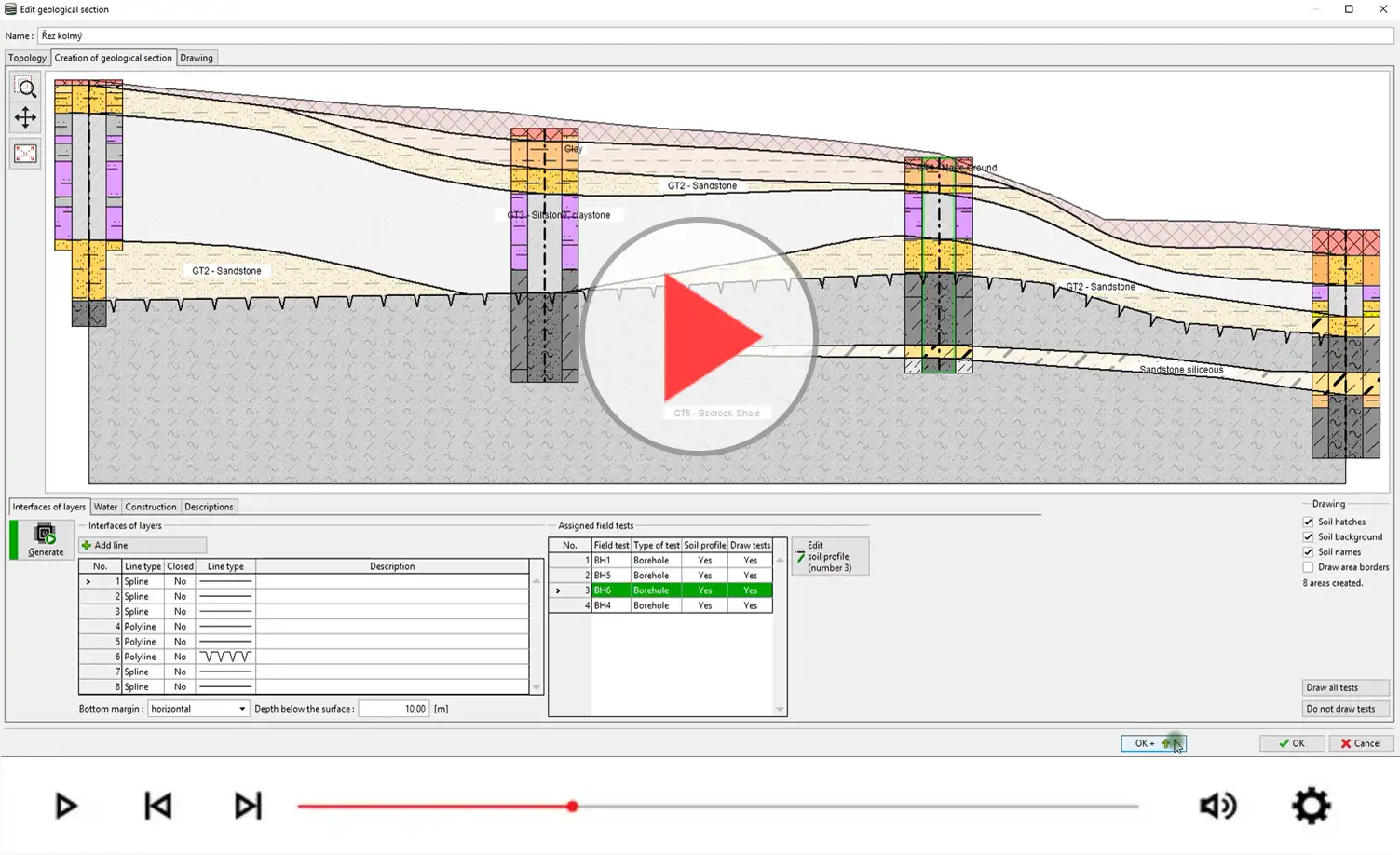
Stratigraphy module Cross Section
Analytical and FEM Calculations
The advantage of the GEO5 software is the ability to combine analytical and numerical methods. Both methods are independent thereby enabling results to be compared and cross checked. The benefit of the analytical approach is the simplicity of the input and the smaller number of input parameters required. FEM calculations which are generally more complex allow more detailed analyses to be performed.
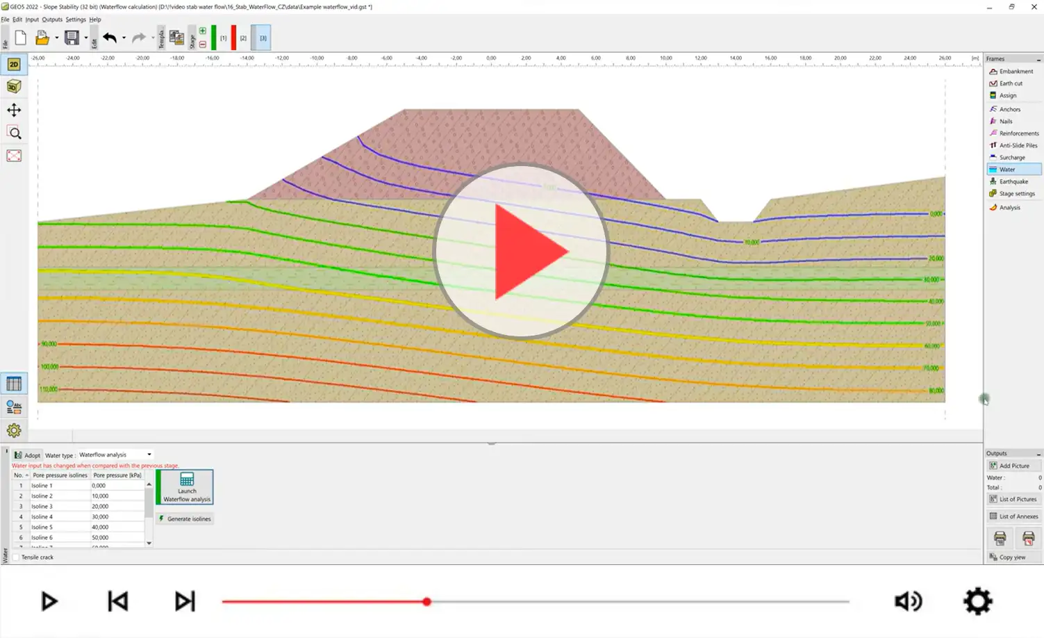
Slope Stability module Water Flow
3D Subsoil Modelling
The basis of good geotechnical design is perfect knowledge of the subsoil. The ideal way to obtain this is to create a 3D model. The model can be also used to copy input data to other programs; i.e. geological profiles or entire geological cross-sections.
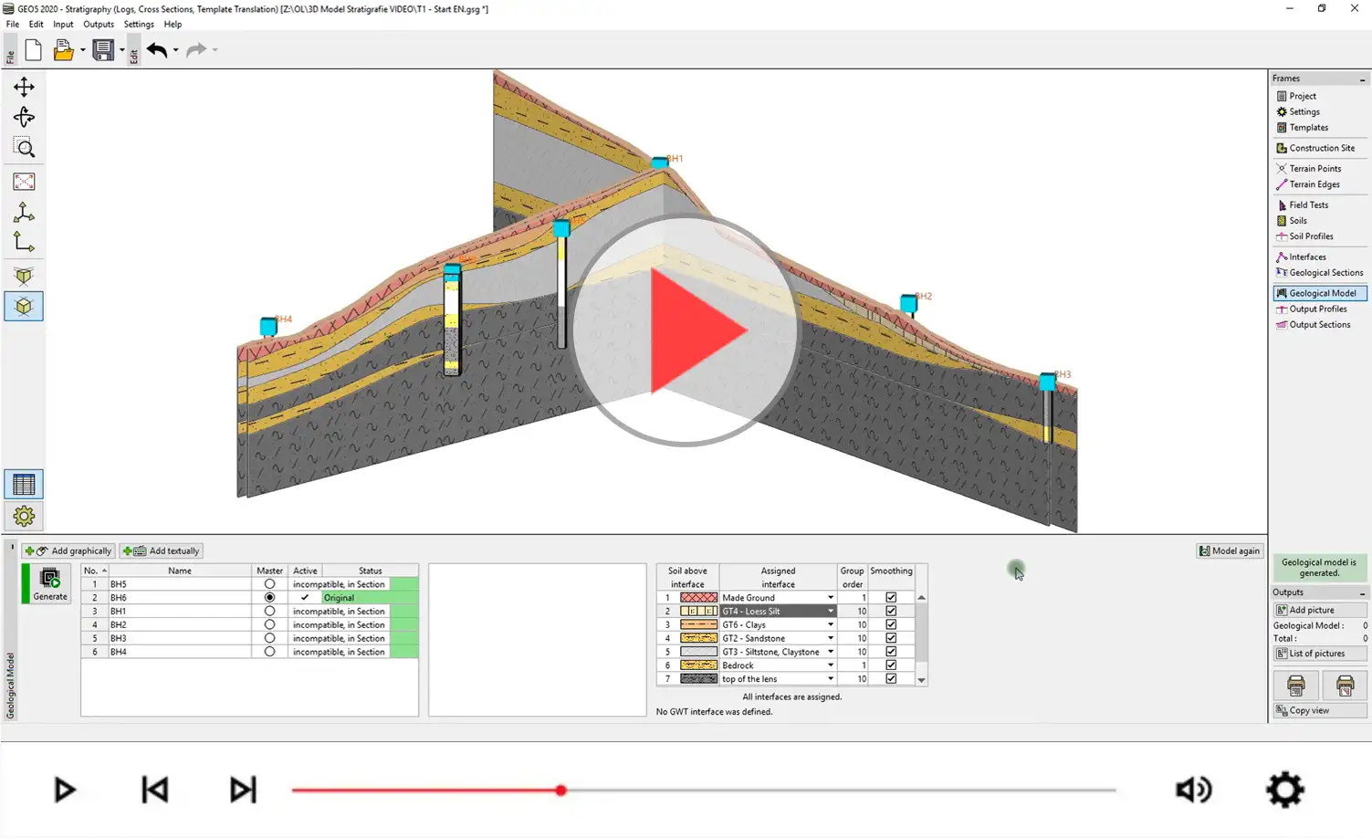
Stratigraphy - 3D Geological Model