Communication between GEO5 Programs
All GEO5 programs communicate with each other via the GeoClipboard, which can be used to transfer large amounts of input data between them - soils, interfaces, project information, various settings, etc.
The programs are also interconnected for related calculations; i.e. a retaining wall from the Gravity Wall program can be immediately checked for global stability in the Slope Stability program, or the bearing capacity of the foundation soil under the wall can be verified with the Spread Footing program. The data from the Slope Stability program can then be sent to the associated Slope Stability – Water Flow module, where the groundwater can be calculated numerically.
Communication with other programs
Communication with other programs is solved through many general formats – table data (txt, xls), CAD, IFC, LandXML, and many others. Most of the data can be both exported and imported.
A special case is the import of field tests - the programs can load data directly as recorded by the measuring machine - e.g. .cpt, .gef, .gru, etc.
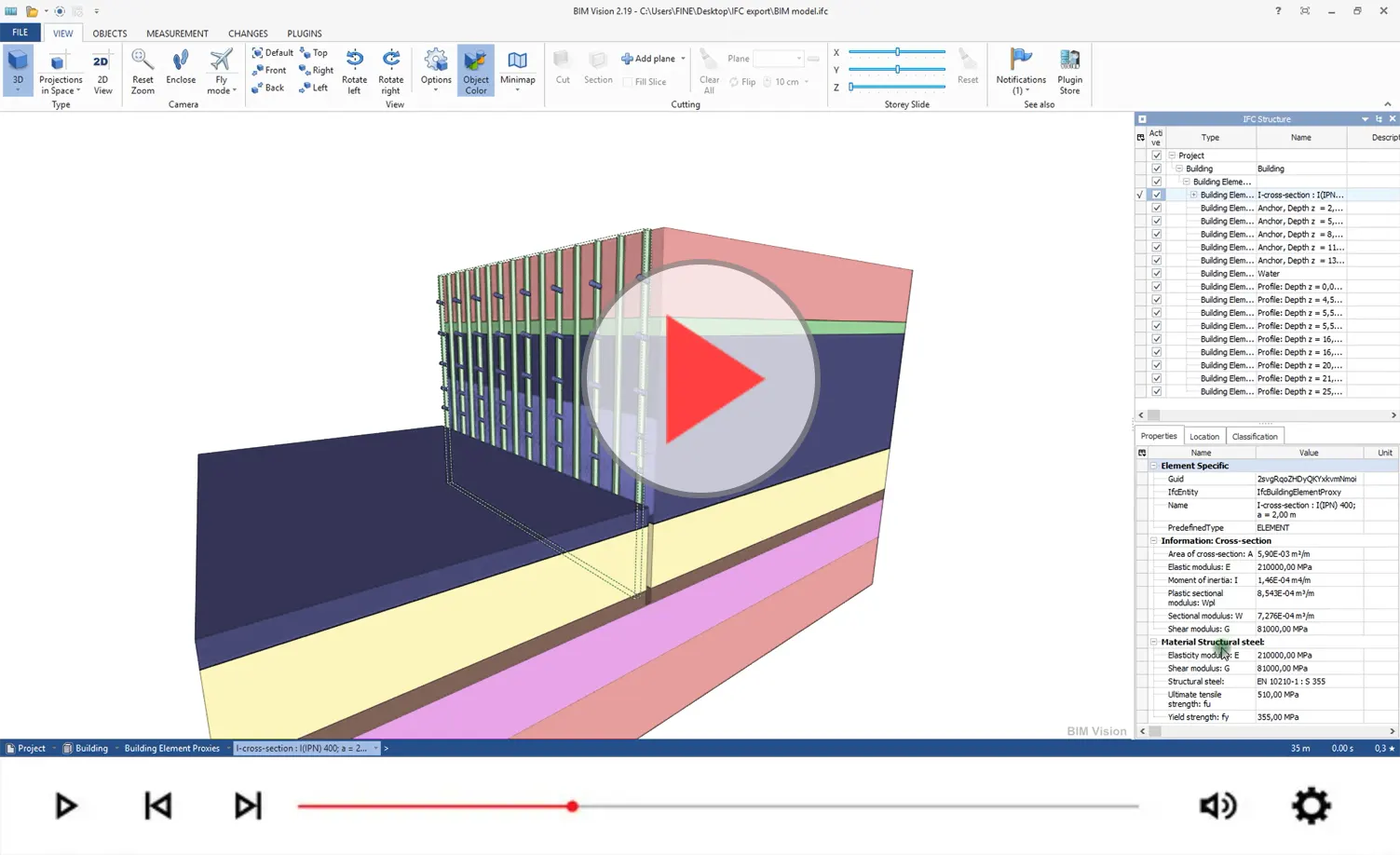
Export IFC data from GEO5
Map and Borehole Survey loading
The Stratigraphy program includes the ability to communicate with geological agencies around the world. This makes it easy to load available geological maps, borehole surveys, etc. into the program.
If cartographical data from your geological service is not available in the programs, please do not hesitate to contact us. With your assistance we will endeavour to implement them.
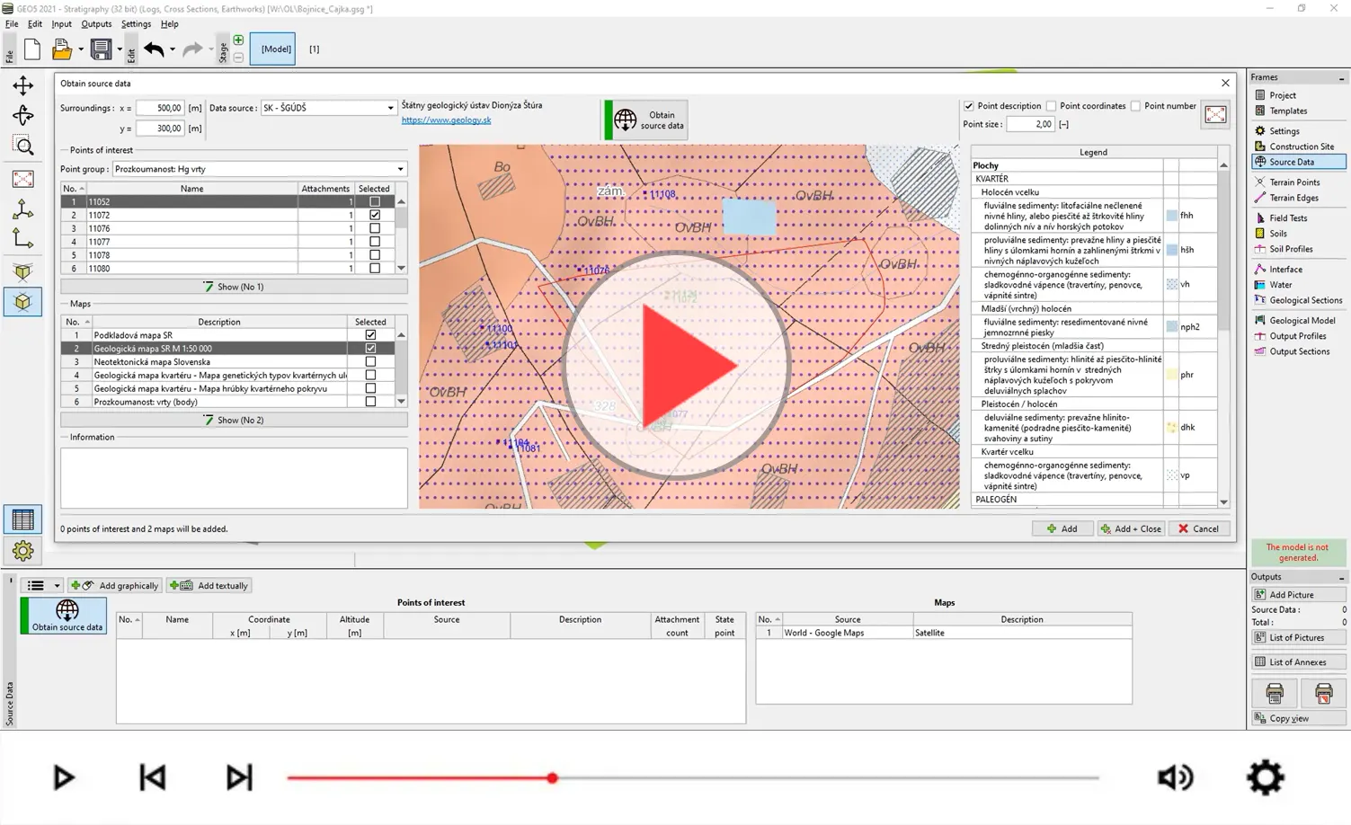
Load available geological survey to GEO5 Stratigraphy