GEO5 and BIM
GEO5 sees a future in BIM technology and is fully working on it. In our view, the following three points are the basis for working in the BIM:
1. The way of working - electronic storage and processing of all data and models throughout the whole life of the structure
2. Communication - the ability to transfer this data between other programs working with BIM technology
3. 4D model - modelling the structure in 3D and modelling subsequent changes over time
GEO5 2022 and geotechnical BIM
Working Methodology
The basic requirement of BIM is that all data which is stored in the program, is not lost, and is available at any time. It is clear what assumptions were made during their creation, what simplifications were adopted, and what the interpretation of the measured data was.
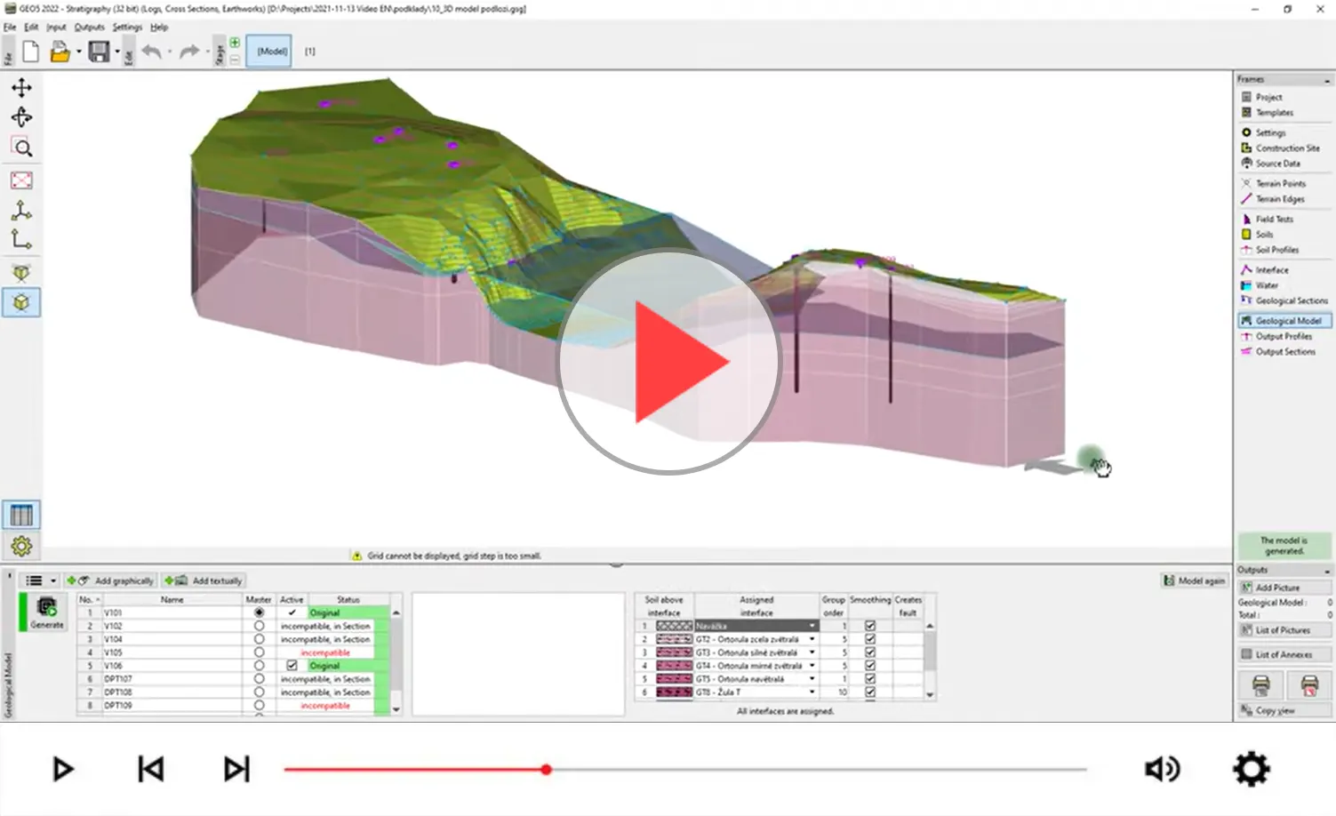
The core of our approach to BIM is the Stratigraphy program, which is followed by other programs. In the program, we start by collating site information to create a 3D model. The models and soil parameters obtained are then used for geotechnical calculations and modelling of the upper structure in other programs.
Communication
GEO5 supports:
– IFC Export of models with the possibility of exporting and defining user data
– Import and export tables and text files at many program levels
– Loading of data and objects from other programs (DXF, DWG, LandXML)
– Use of geotechnical AGS and SEP3 standards
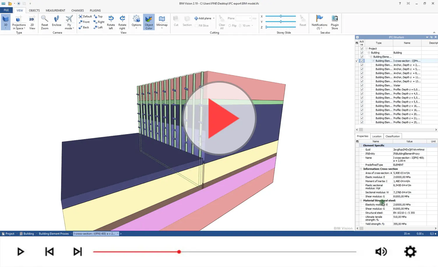
Export IFC data from GEO5
4D model
The basis of BIM modelling is the creation of a 3D subsoil model, which is then developed further. Within the individual construction stages, it is possible to model the earthworks and upload objects – structures. The individual programs then allow the construction history to be modelled.
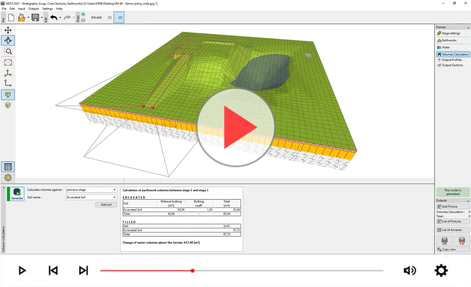
Earthwork modelling in GEO5 Stratigraphy