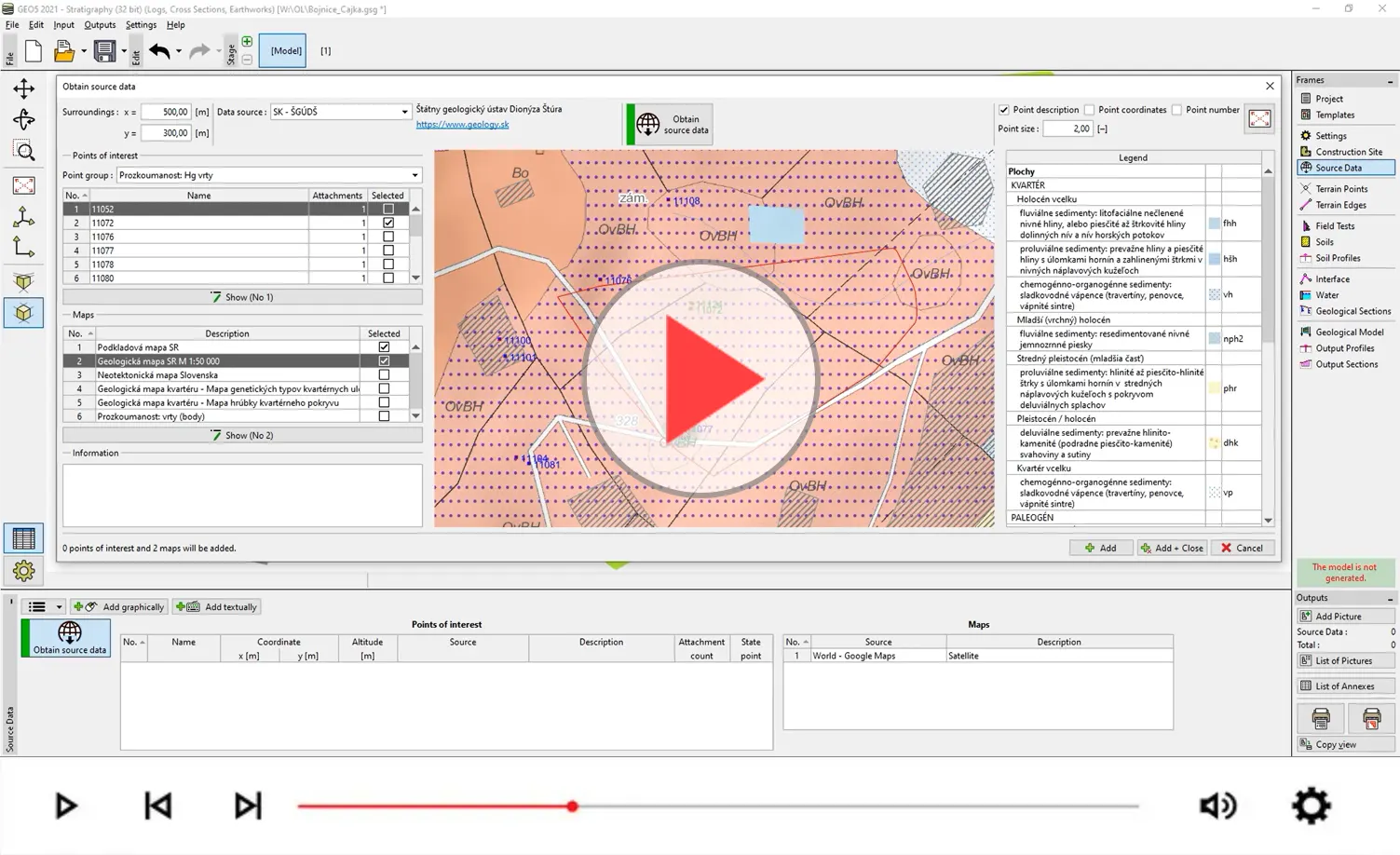
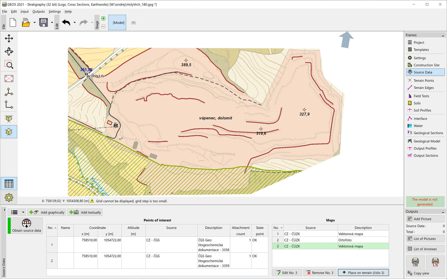
The Stratigraphy program allows to import the geological maps and site investigation data from variety data sources (local geological services, topographic and satellite world maps). If cartographical data from your geological service is not available in the programs, please do not hesitate to contact us. With your assistance we will endeavour to implement them.
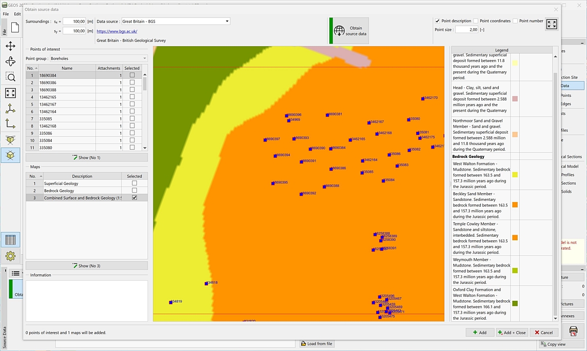
Geological map and
borehole survey - (UK)
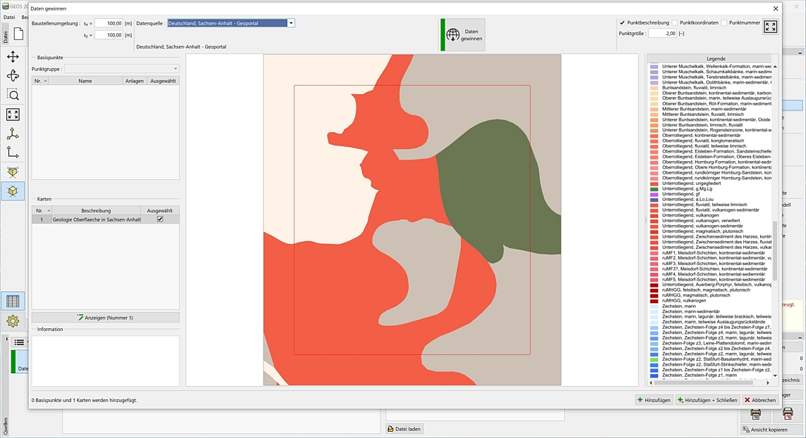
Geological map - (DE)
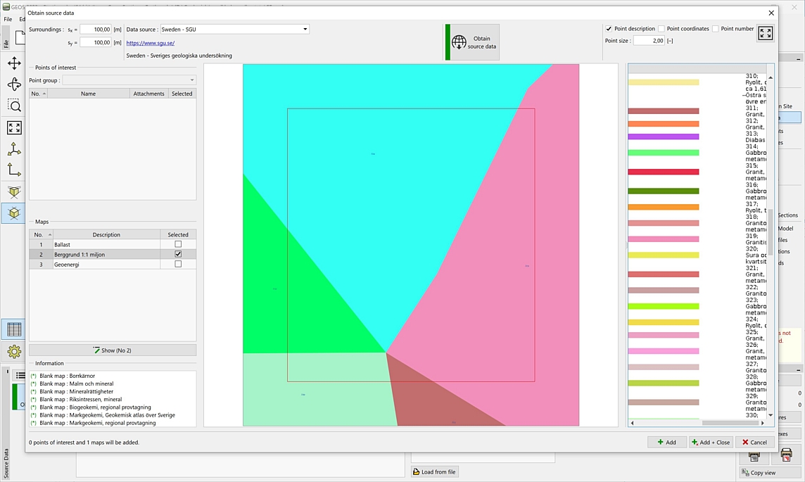
Geological map - (SE)
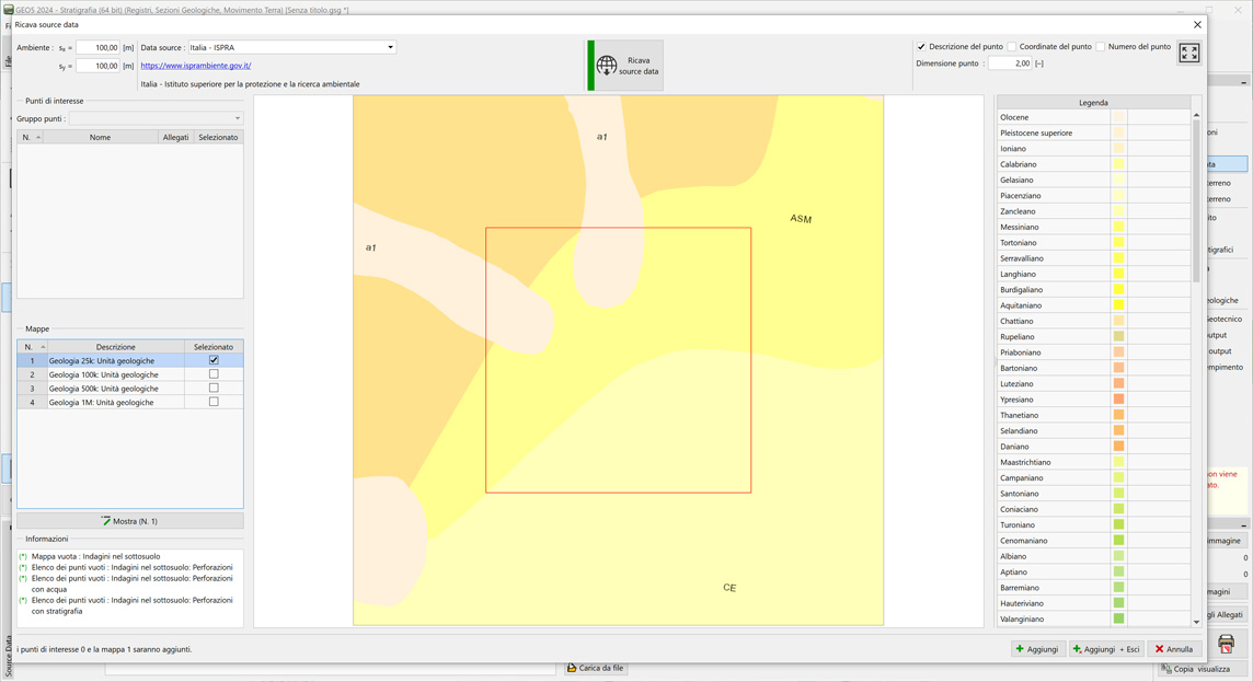
Geological map - (IT)
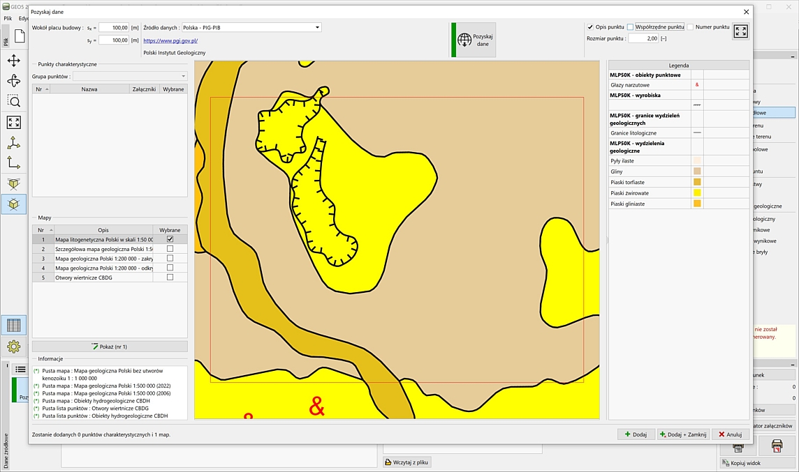
Geological map - (PL)
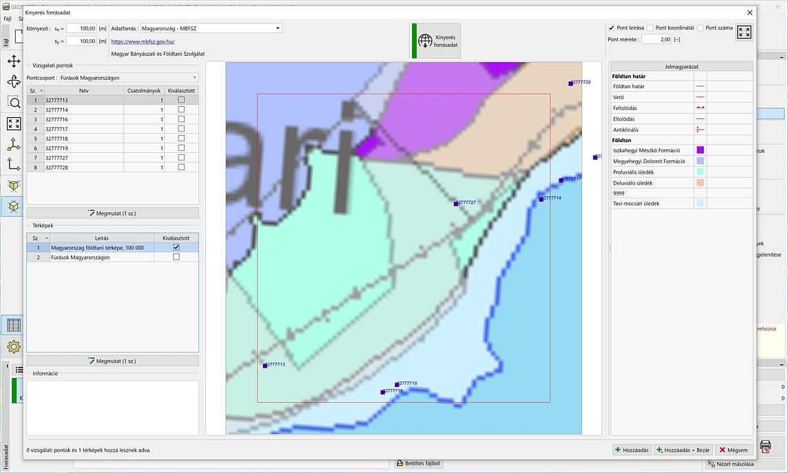
Geological map and
borehole survey - (HU)
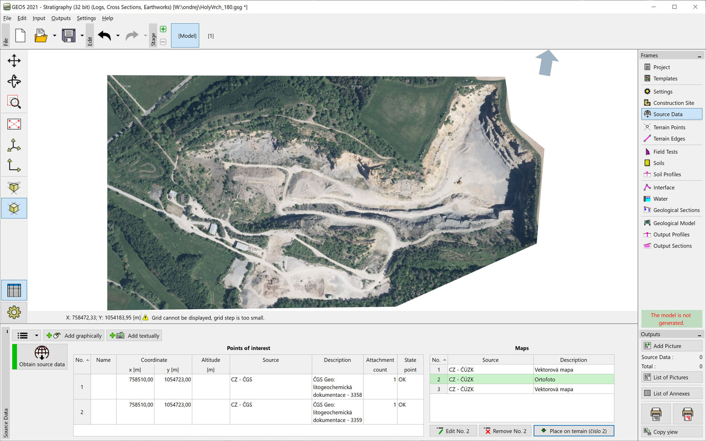
Orthophoto map - ČÚZK
Vector map - ČÚZK
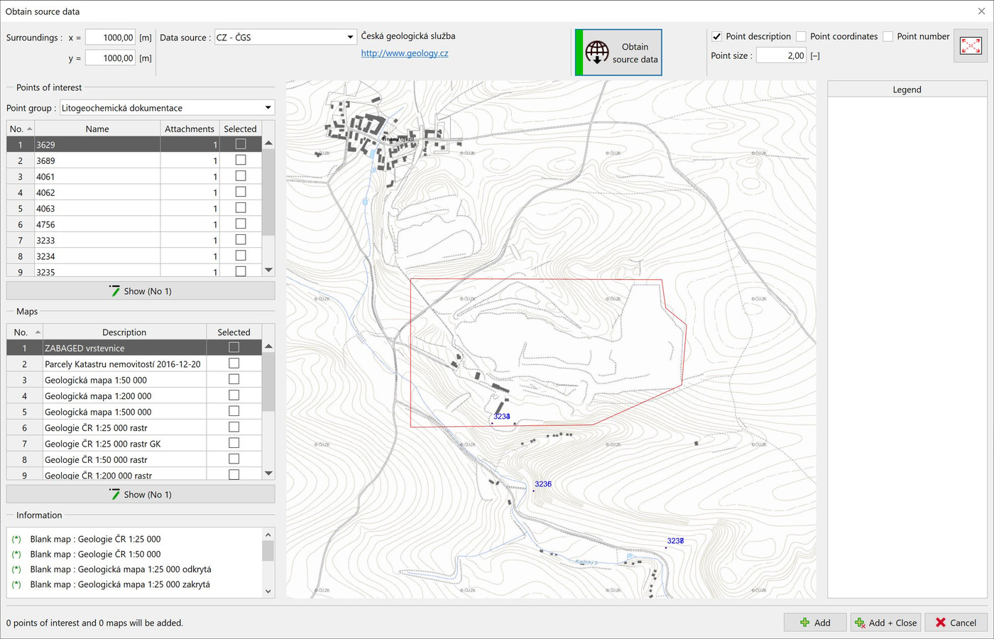
Contour line map - ČGS
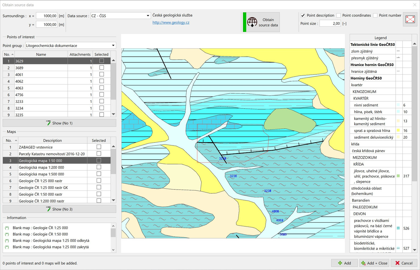
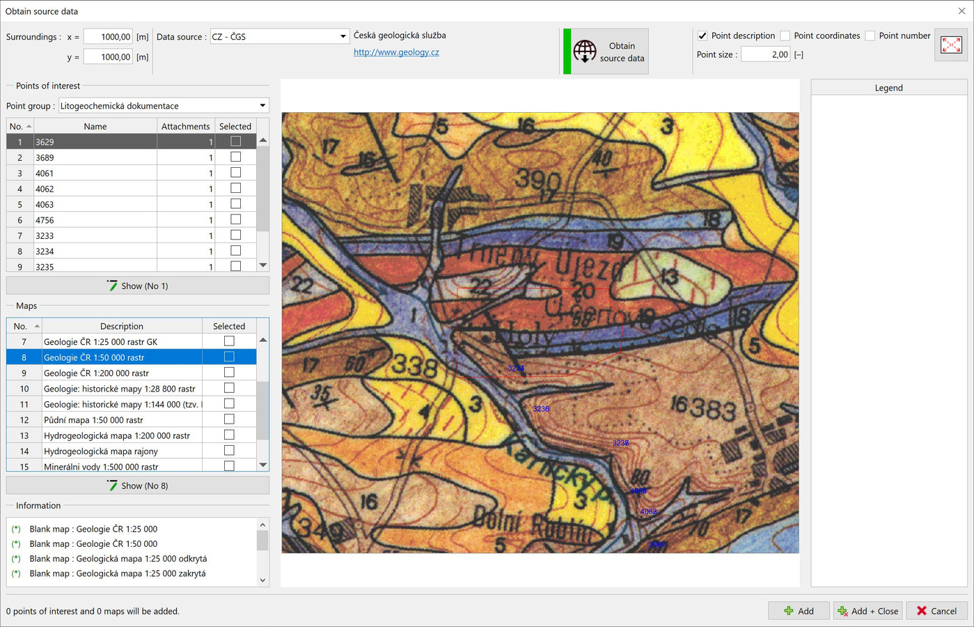
Geological map 1:50 000 - ČGS
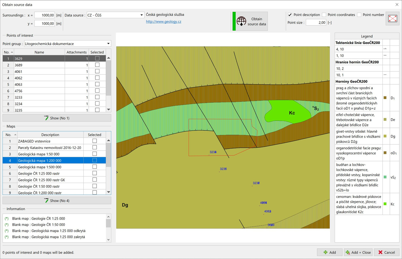
Geological map 1:200 000 - ČGS
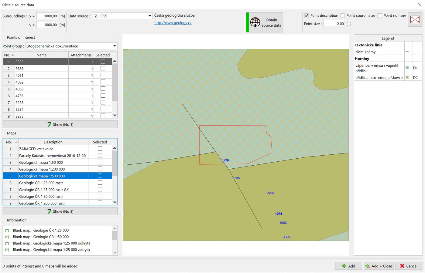
Geological map 1:500 000 - ČGS
CZ Geology map 1:50 000 - ČGS
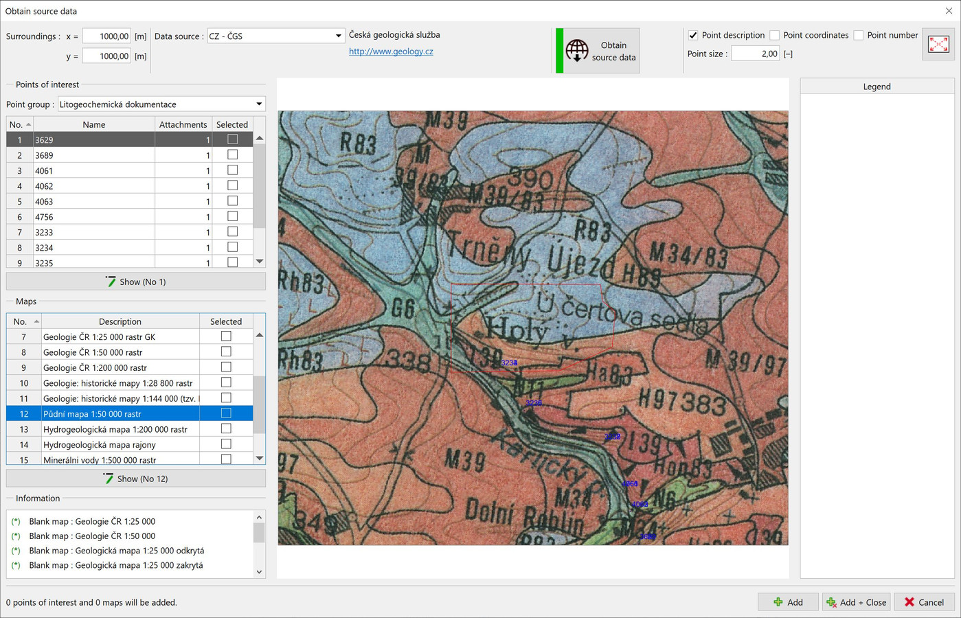
CZ Soil map 1:50 000 - ČGS
See short video how to GEO5 Stratigraphy allows importing the geological maps and site investigation data from variety data sources (local geological services, topographic and satellite world maps).