Active Edges
For a correct generation of the geological and terrain model, the boundary conditions (points heights in corners and edges of the construction site) are very important.
The points and boreholes on the edges of the construction site are automatically created when the geological model is generated. First, the z-coordinate of the closest point (or test) is assigned to the construction site points. Then, the nearest borehole is assigned to these points.
This modeling is suitable for flat terrains. In the case of slope modeling, the model is not created correctly on the edges, where boundary conditions are not defined. Active edge helps to define a boundary condition on the edges of the construction site.
An active edge is shown in red color.
When a model of the terrain is generated, all points and tests with entered z-coordinate in the active edge create an assistant point on the model boundary. Connections between points (tests) and assistant points are shown in blue.
When a geological model is generated, all boreholes and interface points in the active edge create an assistant borehole on the model boundary. Connections between boreholes and assistant boreholes on the edges are shown in orange.
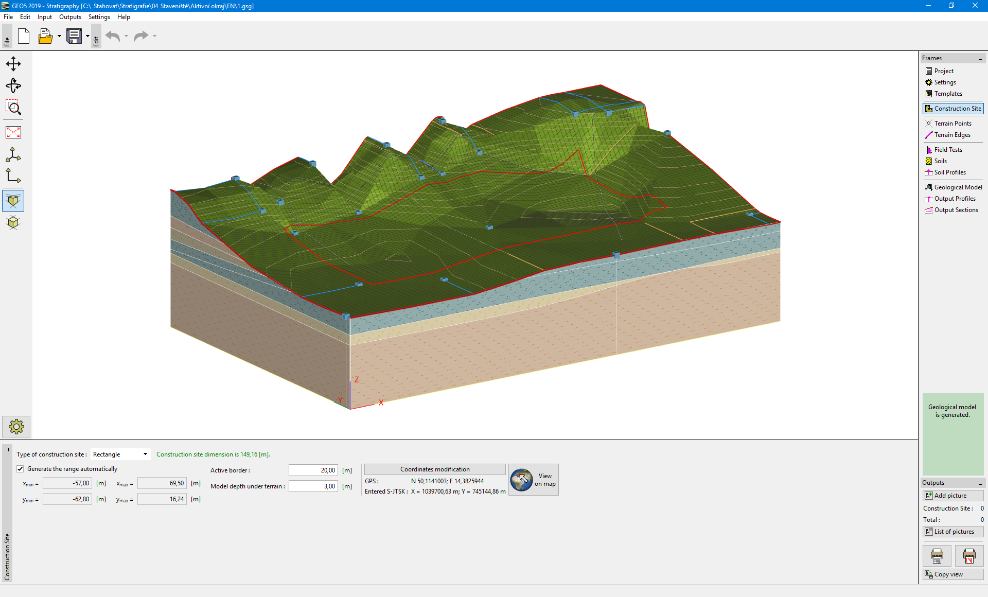 Frame "Construction Site" - active edge settings
The use of active edges is also explained in the example of Construction Site Edges.