Terrain Points
The coordinates of the terrain points are entered in the frame "Terrain Points". The dialog window "New terrain points" serves to add new points.
When new points are entered into an already generated model, the heights of points Z are automatically calculated. Only one point can be added to one X, Y coordinate.
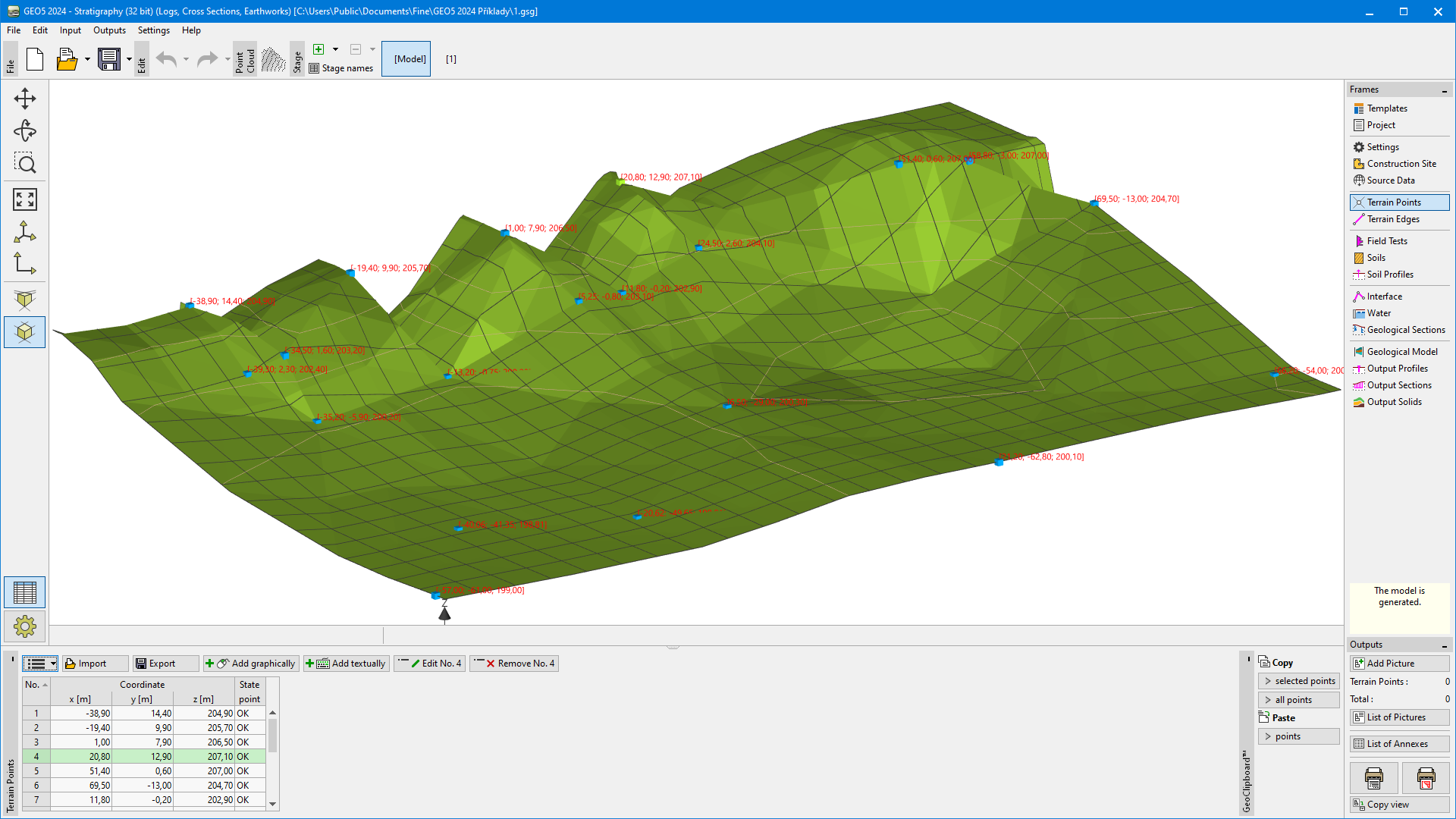 "Terrain Points" frame
The terrain model is always generated after every addition or change of an arbitrary point.
The points can also be imported using the "Import" button in various formats, or it is possible to transfer data from the "Point cloud" program.
- Text tables
- XLSX and ODS Tables
- CAD format data (*.dwg, *.dxf, *.dgn, *.ifc, *.ifcZIP)
- LandXML (*.xml)
Point coordinates can be converted from another coordinate system or GPS before importing.
The program allows us to import an unlimited amount of data (points, edges), but the generation of the model with a very high number of points or edges can be time demanding and usually is unnecessary. For example, the import of edges from the contour lines is not recommended; the import of surface points only gives good results.
In the case that data contains more than 1000 points or 100 edges, the dialog window for the reduction of imported data is displayed. Using reduction, a new number of points or edges is shown according to the entered minimum distance between points. The program averages points which are nearer than input distance. For fluent work, it is recommended to import maximally 10 000 points.
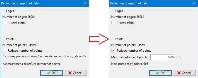 Reduction of imported data
When importing edges, it is not possible to reduce the number of points at all.
Visualization of drawing on the desktop can be modified in the "Drawing Settings" frame and with the help of buttons on toolbar "Visualization".