Construction Site
A "Construction Site" defines a boundary of the 3D model.
It can be automatically generated (rectangle, convex hull) from the entered terrain points and field testsor entered manually (rectangle, polygon).
If we don´t know the exact coordinates of the construction site, they can be defined using the "Rectangle GPS" option.
For the "Input line construction and generate polygon" option, the road axis and site width are entered - this can be uniform for all points or locally different, which is suitable for extensions around crossings, etc.
A construction site can also be transferred from the "Point Cloud" program.
Entered points of the construction site boundary, don't have a defined z-coordinate, which is automatically calculated as a coordinate of the nearest valid point of the model (point, field test with z-coordinate).
Points and layers in the active edge are also transferred into the construction site boundary.
Terrain points and field tests can also be entered (imported) out of the construction site boundary. If the dimensions of the construction site are manually entered, these points and tests have a description "Out of construction site", and they are not displayed on the desktop. In the case of automatically calculated dimensions, the construction site is regenerated.
It is also possible to show the construction site on Google Maps.
If the dimensions of the construction site are too large (distance between points is larger than 5000 m), the program does not draw a construction site, and it is necessary to revise the model.
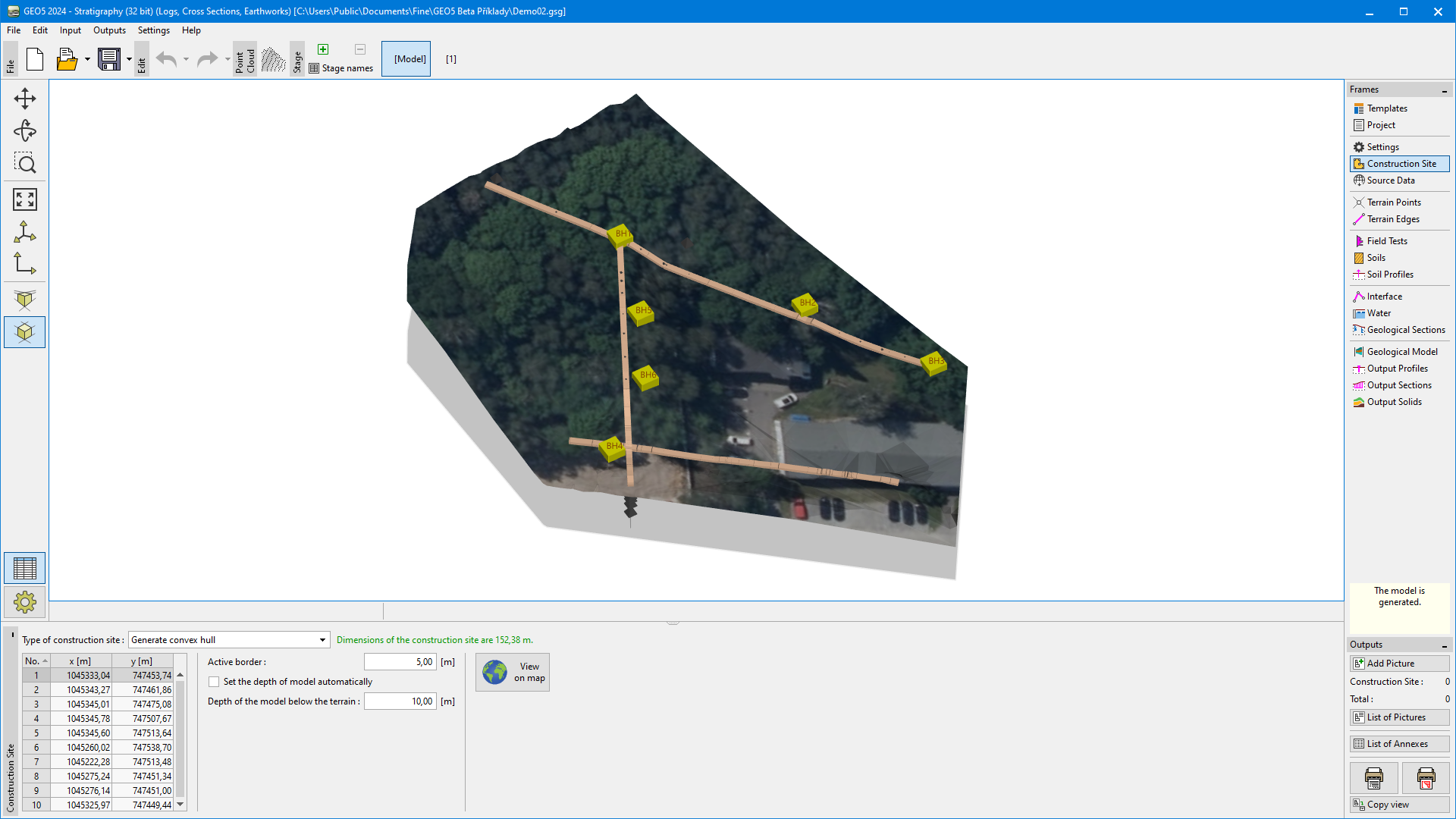 "Construction Site" frame - convex hull
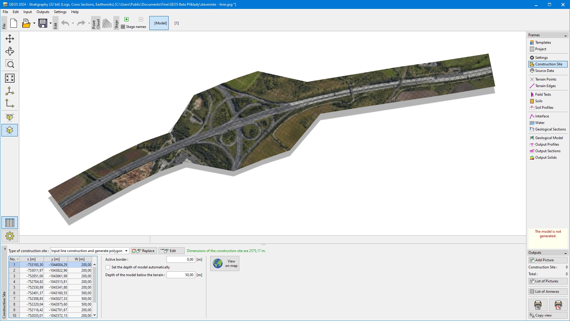 "Construction Site" frame - line construction