Creation of Geological Section
The geological section is created using arbitrary lines similar to CAD programs.
By graphical input, the arbitrary points can be defined by the left mouse button. Points of lines can be snapped to the entered soil profiles, but it is also possible to enter them on other lines or interfaces.
Graphical input is terminated by double click on the same point. It is possible to modify the geological section by shifting a point.
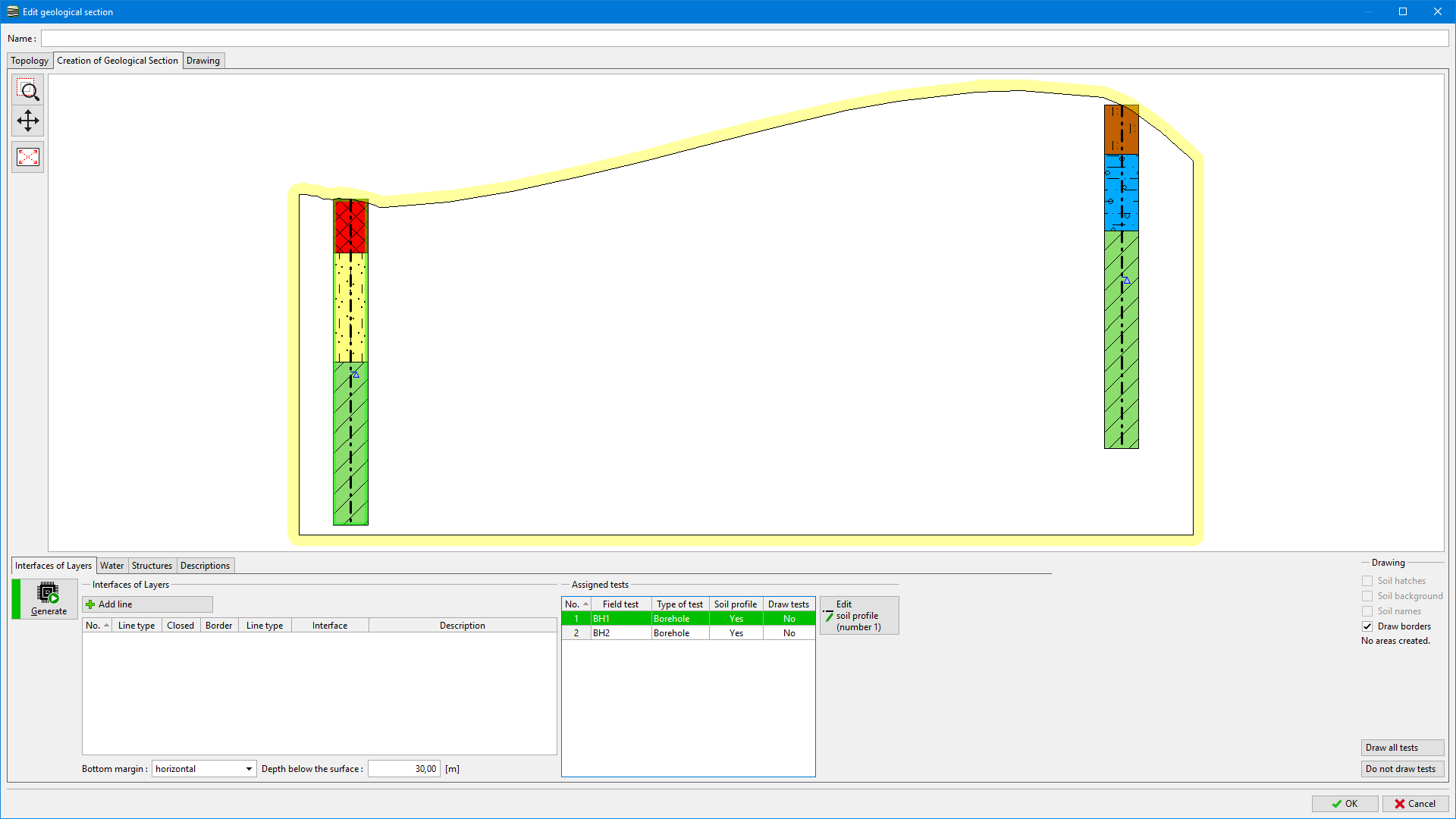
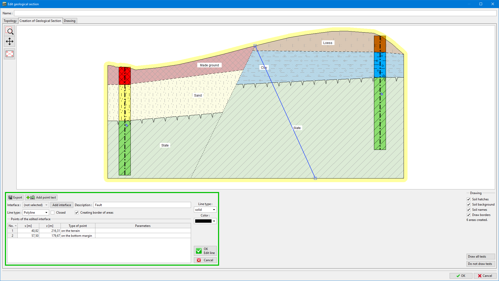
As an example, we show an input of geological fault between two boreholes.
 Geological Sections - "The creation of a geological Section" Tab
1. We define a fault - line going from the terrain to the rock massive.
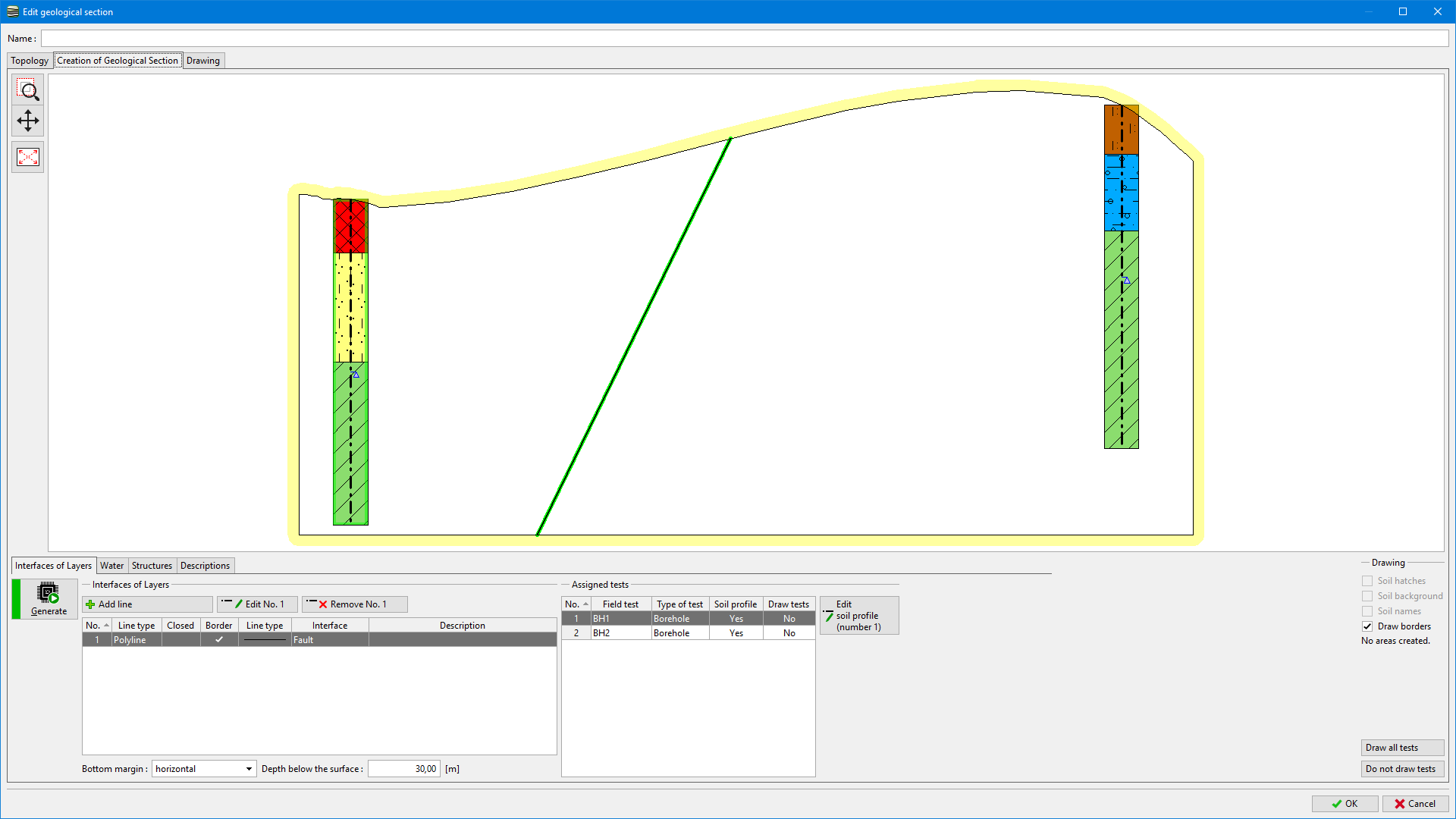 Input of a Fault
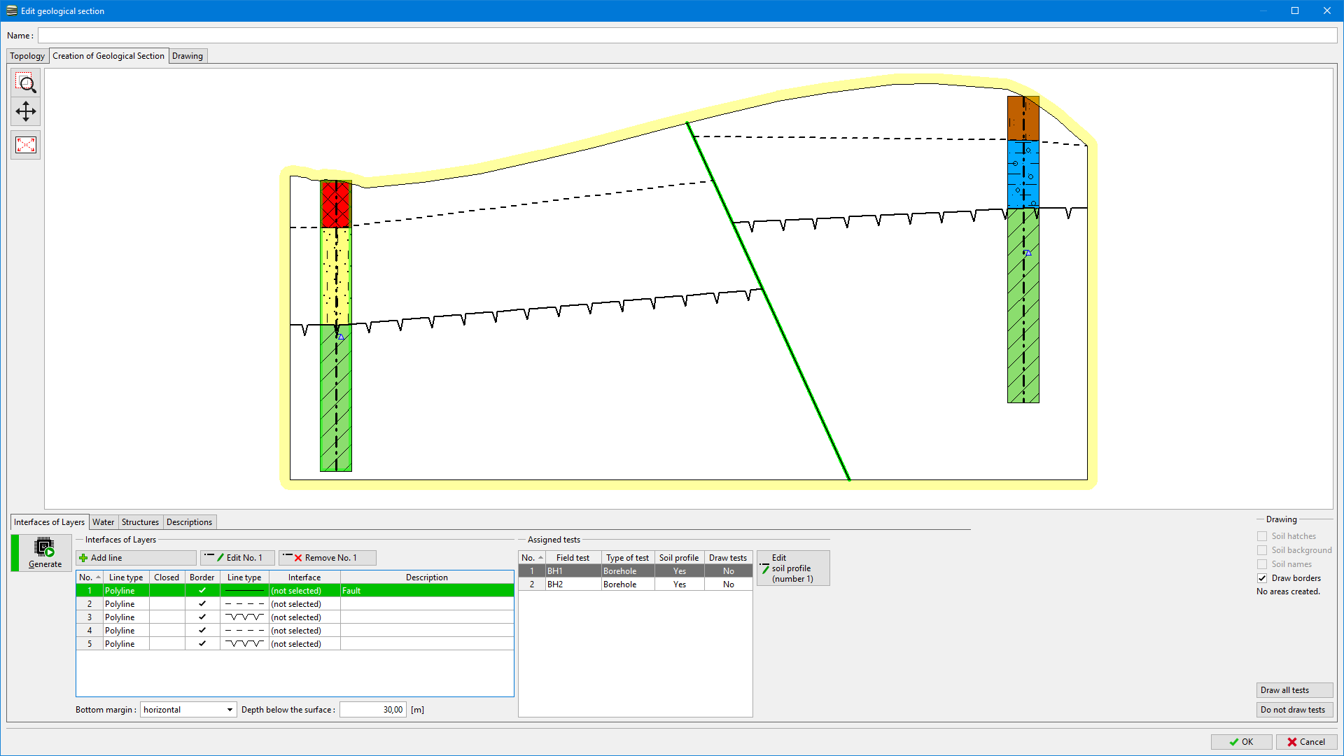
2. We define estimated interfaces, which we snap
- on the section edge
- on the interface in the soil profile
- on the created fault.
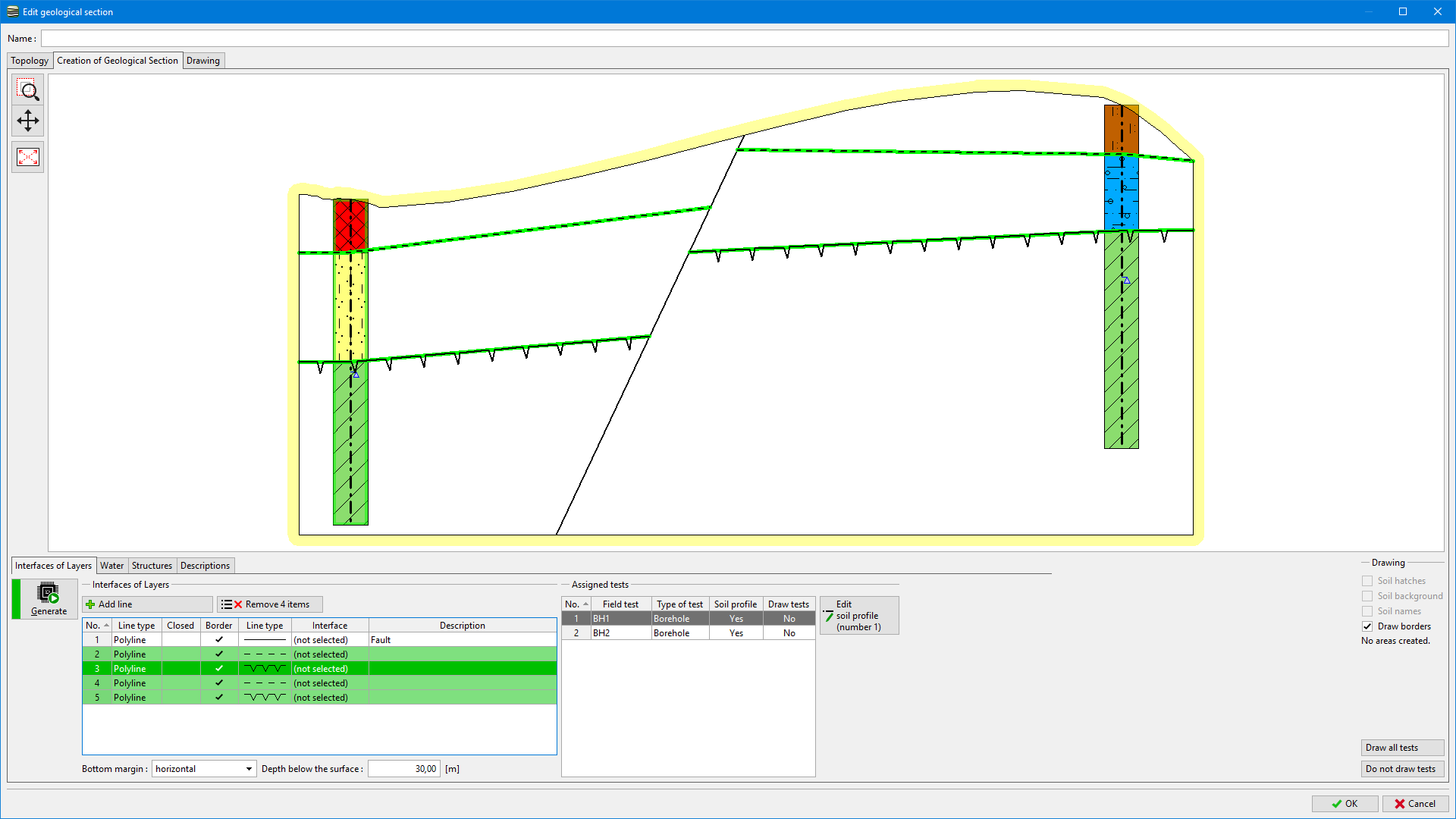 Input of Estimated Interfaces
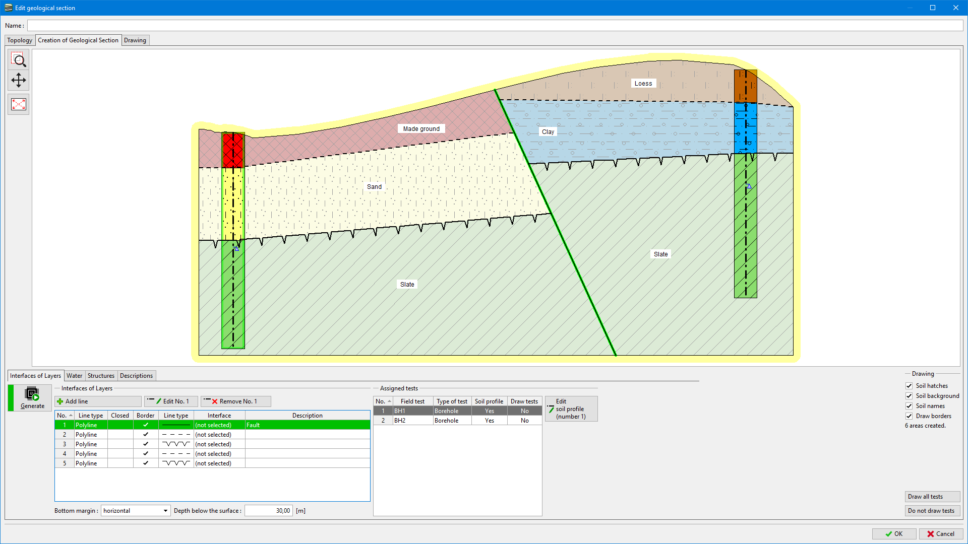
3. We generate areas of soils.
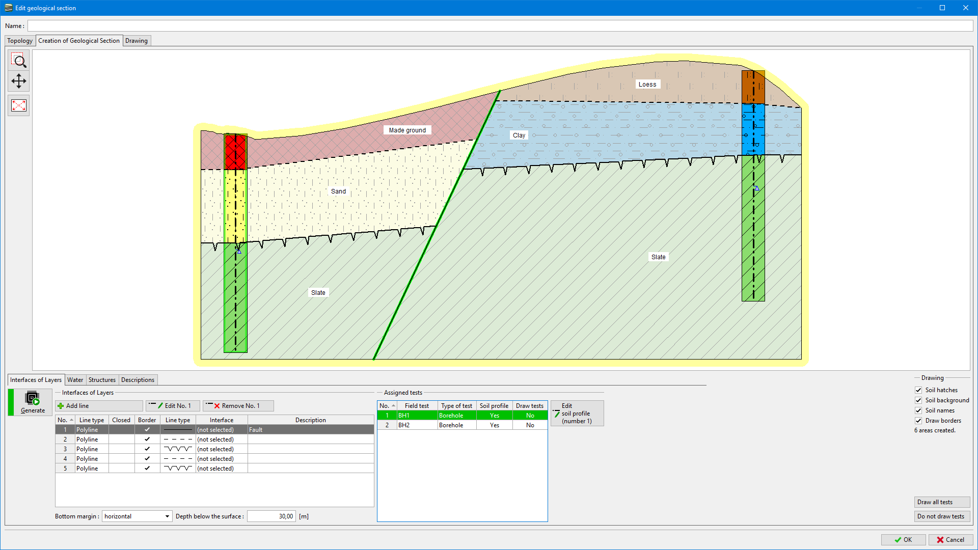 Generated Areas
We can change the geological section by shifting the bottom point of the fault.
 Edit of Fault Line
 Modified Fault
 Newly Generated Areas