Own Source Data
The program allows to import own source data in the *.jpg, *.jpeg, *.jpe, *.png a *.bmp formats. Using the "Load from file" button, the dialog window for import is opened. In the window, we select the file and load it.
The loaded file is shown in the right part of the "New map" dialog window. On the left, the construction site is displayed. It is also possible to draw all known points on the construction site - e.g. field tests or points of interest. The file is placed using the tying two points (A, B). In our example, we want to display the utility plan on the terrain because of the construction of the new house. We know, that boreholes BH4 and BH6 were carried out in the future corners of the planned house. So we place the points (A, B) to the position of BH4 and Bh6 boreholes on the left side and to the position of planned corners on the right side.
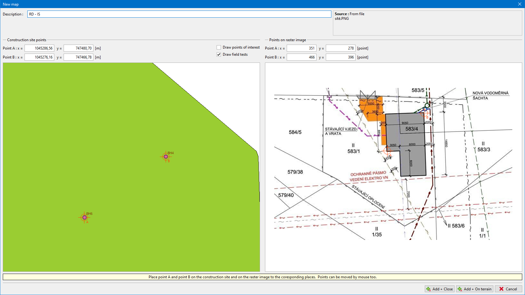 Placing of points to the corresponding places
The points can be shifted using the mouse. The picture (map) is inserted using the "Add + Close" button into the list of sources, or it can be displayed directly in the model using the "Add + On terrain" button.
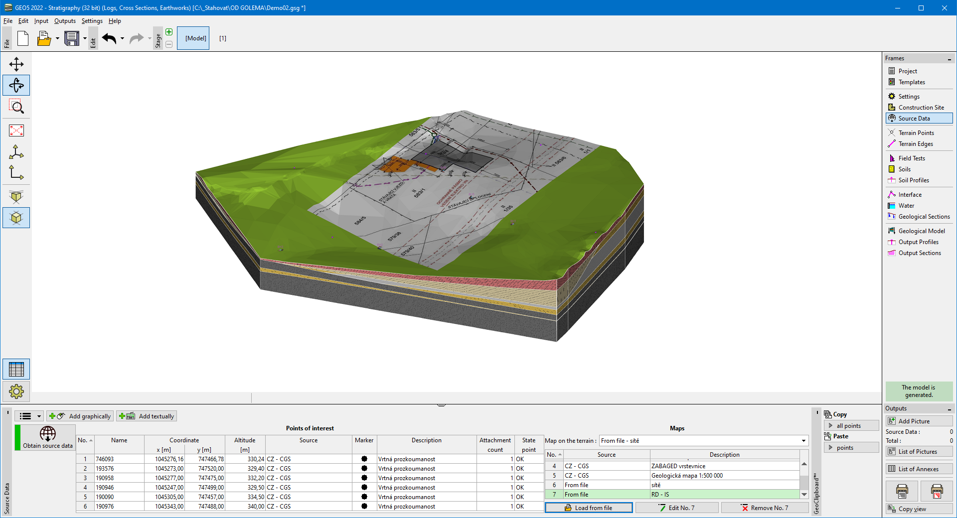 Import of own source data