Construction Site Edges - Active Edge
Turn on the "Frame visualization of soils" in the drawing settings from the previous task.
Edges of the model are created just from assistant boreholes in the model corners - layers are almost straight on the edges of the model.
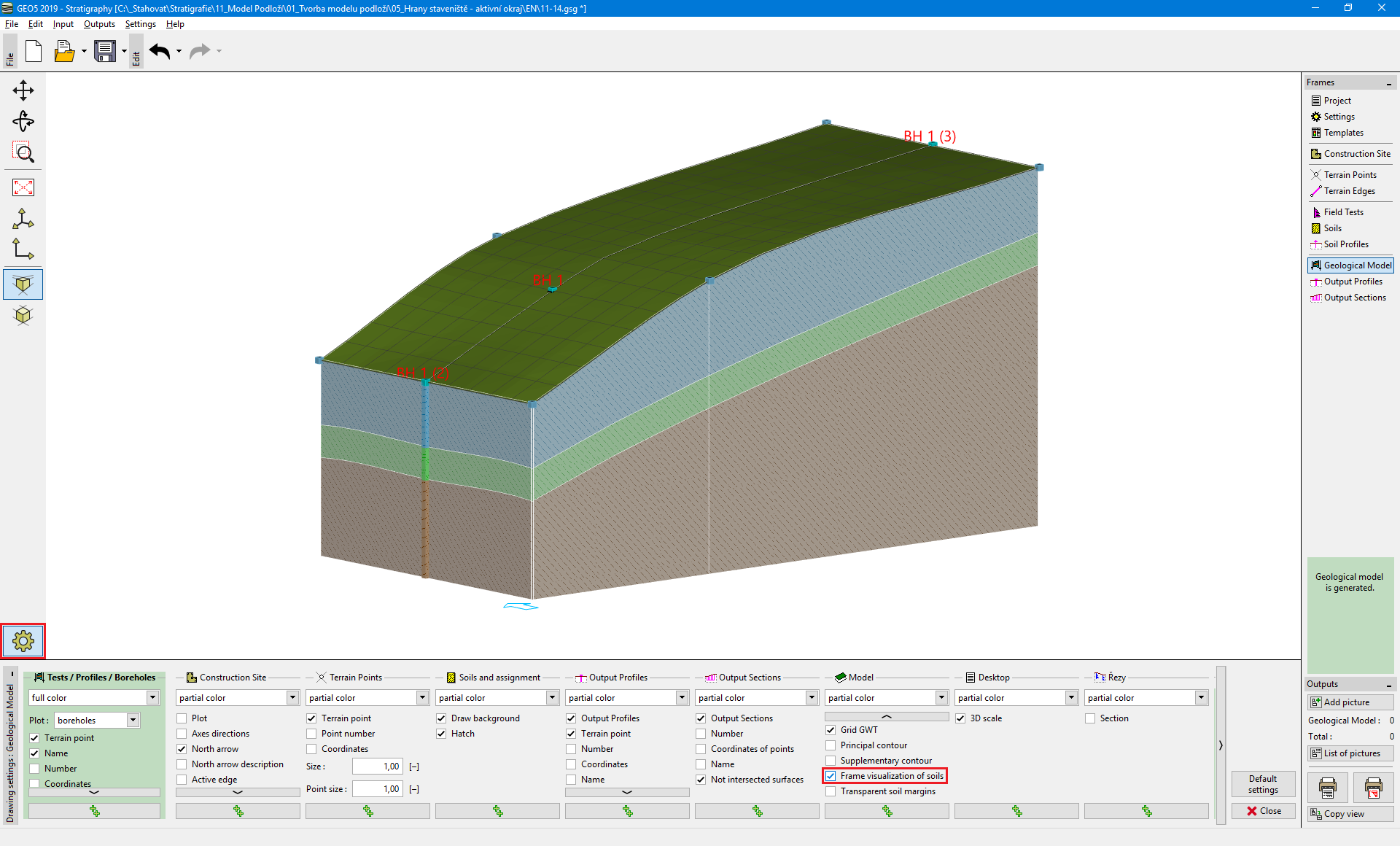 Geological Model with straight layers on edges
Switch to the "Construction Site" frame and enter an "Active edge" [1 m]. The active edge is red.
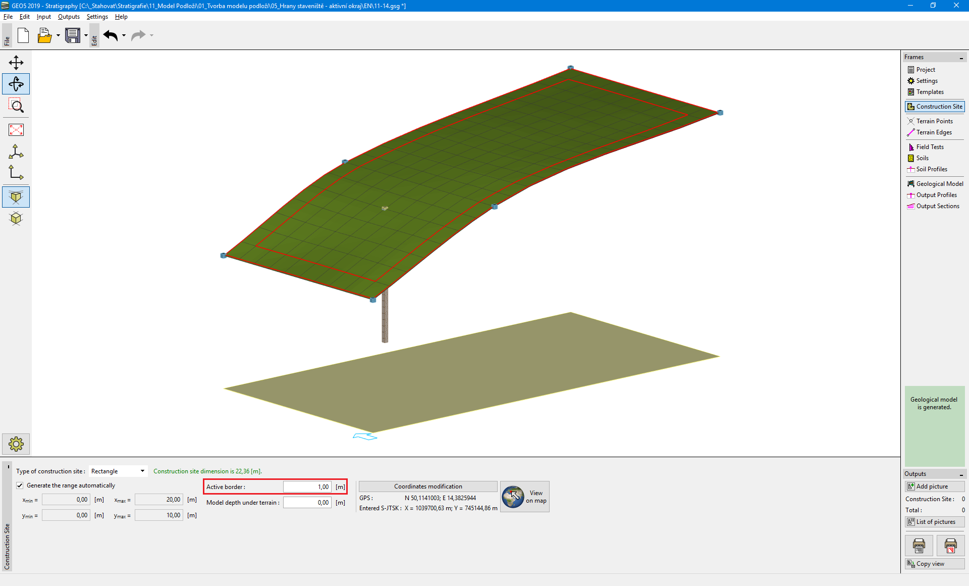 Active edge visualization - "Construction Site" frame
Borehole "BH 1" is not in the active edge, so the generated model remains the same. Switch to the "Geological model" frame, select borehole BH 1, and add two new boreholes "BH 1(4)" [5; 0.5] and "BH 1(5)" [5; 9.5] using the button "Add textually".
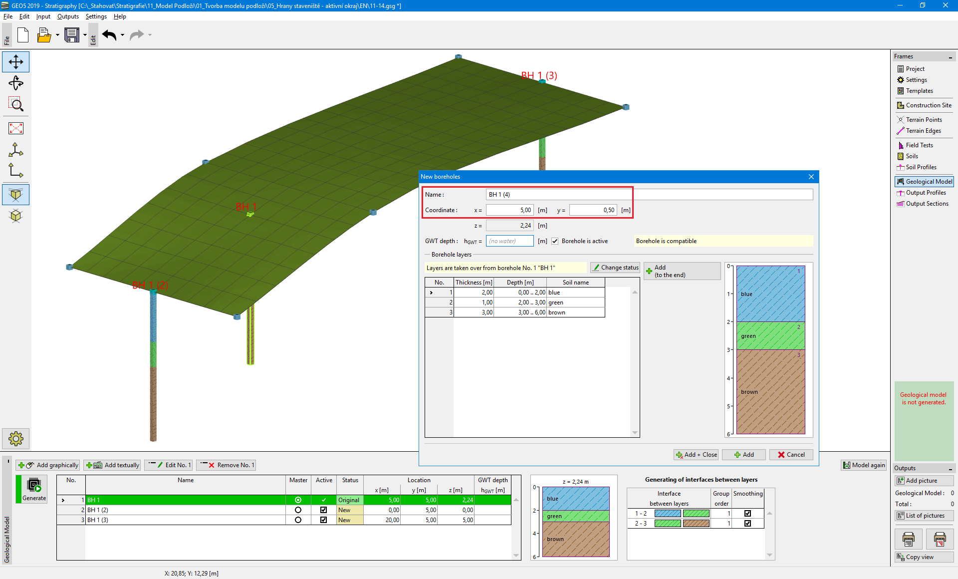 Input of new boreholes into the active zone
The edges of model have significantly changed. Now the shape of the layers is the same as in the cross section in the middle.
Both boreholes lie in the active zone - during the generation of the model, temporary assistant boreholes with the same layers are created on the borders.
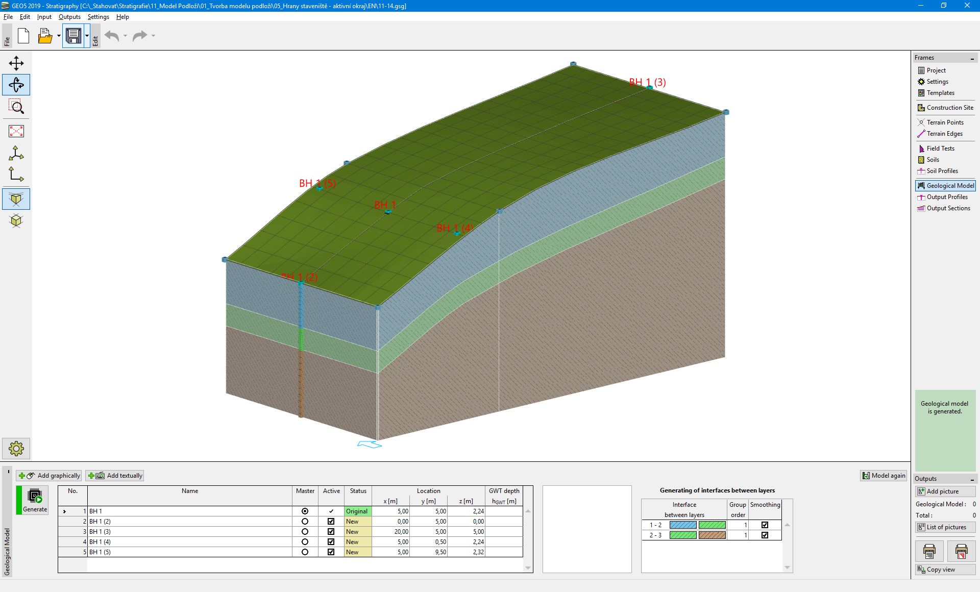 Final model
When modeling real constructions, it is reasonable to enter an active edge to reach the closest points and boreholes from the construction site edge.