Example of Modifications
An example use case might look like the screens below. The description of the rows in the table (and our steps) is as follows:
- Initial model - contains over 71 million points
- Change the coordinates of the whole cloud - the points were focused by the drone with rotated signs for the x and y coordinates, so it was necessary to change them. The number of points is unchanged.
- We have marked our polygon of interest - the rest of the cloud is not of interest to us at the moment. Therefore we have removed all points outside the polygon. The new number of points is over 14 million.
- We have removed a certain percentage of the points that made up the noise above our cloud - the number of points has dropped by about 400,000.
- We performed a reduction in the number of points in the 1 m grid considering the removal of vegetation cover - the new number of points is about 31 thousand. We have also marked that this polygon creates a construction site - it will be used when transferring data to the "Stratigraphy" program. Data can be transferred from this program to other GEO5 programs.
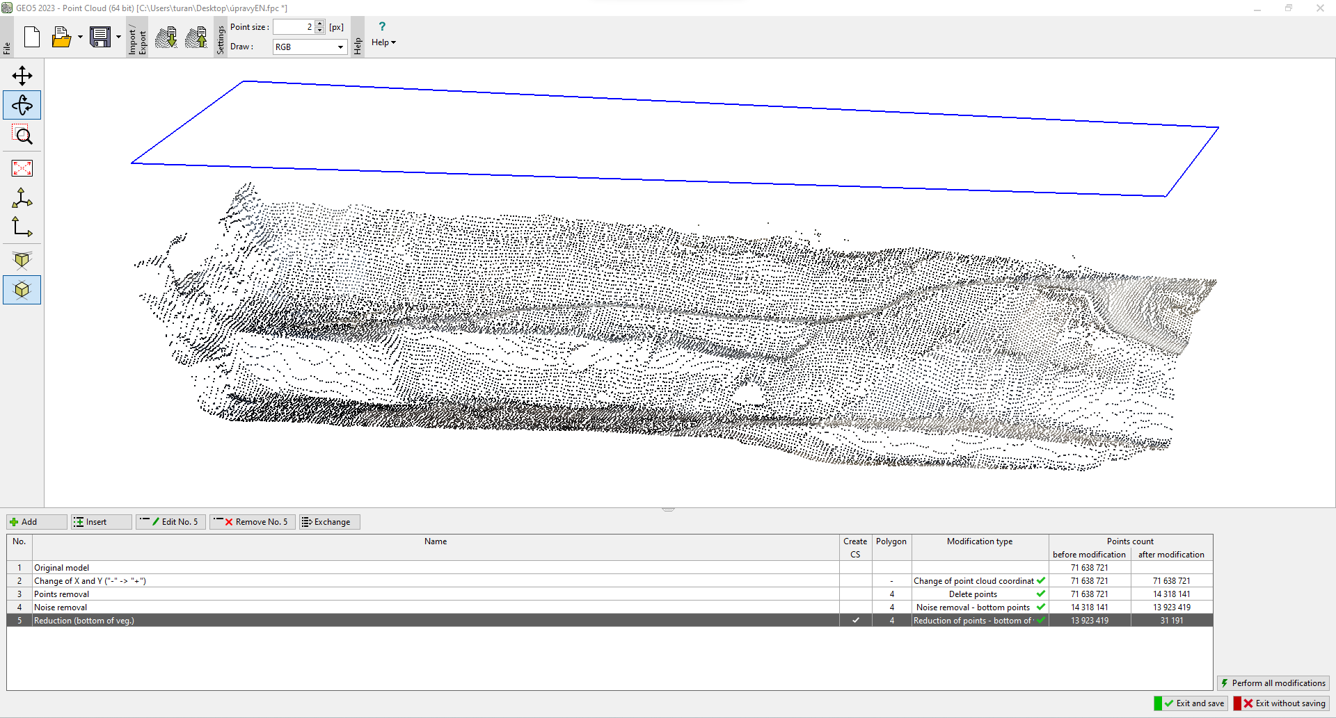 Point cloud modifications performed
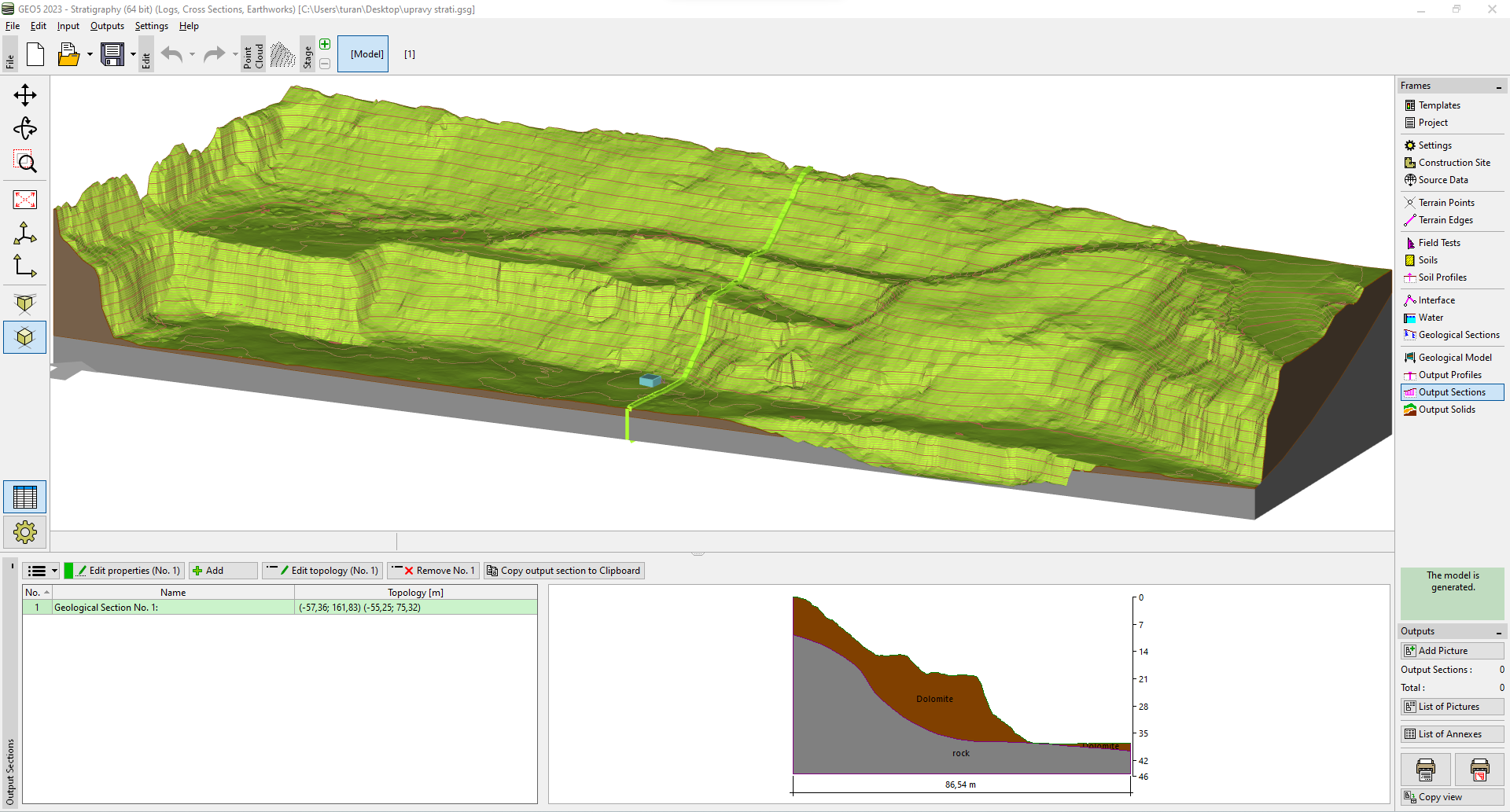 Imported construction site and subsequently created model in the "Stratigraphy" program