Maps and points of Interest
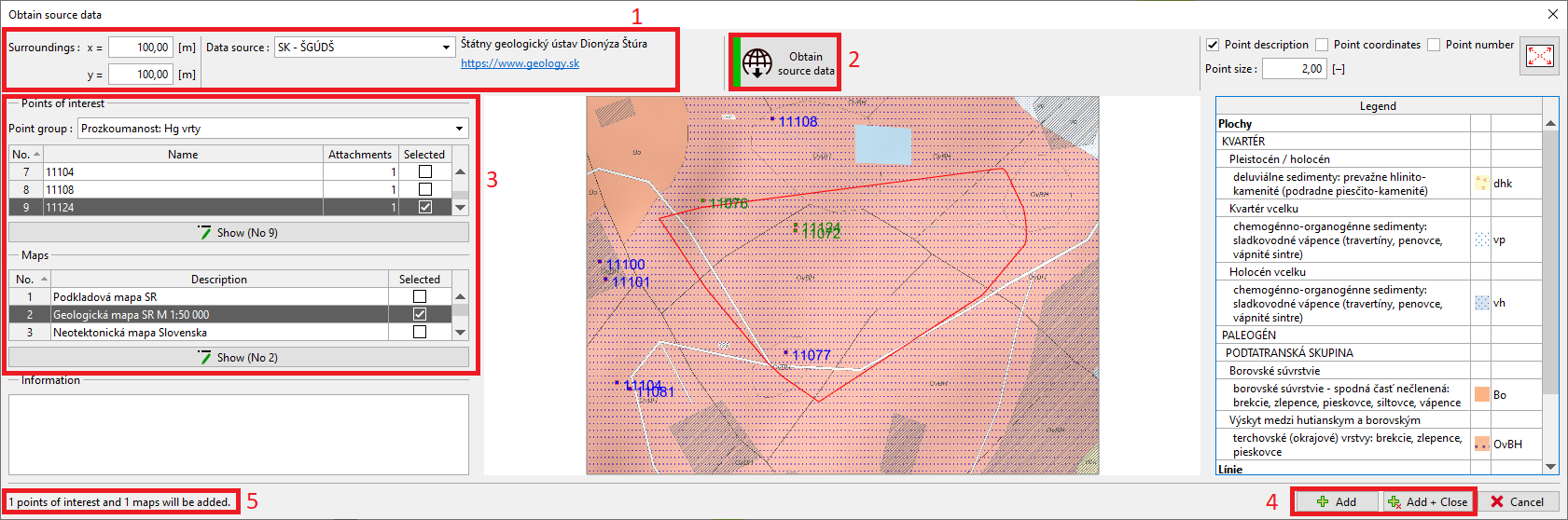
All data which relates to the construction site can be obtained in the "Obtain source data" dialog window. The construction site is bordered in red in the middle of the window. In the same part of the window, currently selected map and available points of interest are displayed. It is possible to zoom or select points using the mouse.
In the upper part of the window, the data source and surroundings of construction site is defined (1). In the current version of the program, the general sources (OpenStreetMap, Google Maps) and local sources of Czech and Slovak Republic (e.g. ČGS, ČÚZK, etc.) are implemented. We will be happy to implement other sources according to the customers feedback.
Using the "Obtain source data" (2), the available maps and points of interests will be loaded (3). They can be added to the model using the "Add" buttons (4) in the right bottom part of the window. The number of added points and maps is shown in the left corner (5).
 "Obtain source data" dialog window
Note: Legend of the map is shown in the right part of the window only in case that source data allows it (here the geological map of Slovak Republic).