Stage Settings
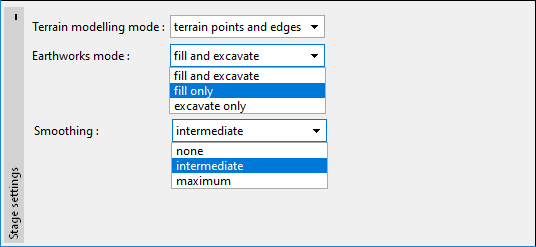
In this frame, the "Terrain modeling mode" for the current stage is selected. Two ways can be used.
The modeling of the terrain using "terrain points and edges"
The new terrain is modelled using the terrain points and edges and it is independent of the previous construction stage or original geological model. Only the dimensions of the construction site remain the same. This approach is recommended in case we have a geodetical measurement in the given time period. It is also possible to transfer data from the "Point cloud" program.
After points input, the terrain is generated automatically.
The "Earthworks mode" is an important choice. The terrain can be changed using the following modes:
- Fill and excavate against the original state - it is appropriate for landslides measurement, modeling of embankments, landfills.
- Fill only - in this case, the space between original and new terrain is filled with soil. It is advantageous, that the new terrain can be modeled easily by the input of only one point.
- Excavate only - the original terrain is cut by new terrain. It is advantageous, that the new terrain can be modeled easily by the input of only one point.
The smoothing of the terrain in the current construction stage is also selected in this frame. If we have a detailed measurement of the whole model, it is appropriate to smooth the terrain. If we have only part of the terrain for cutting the model or for the embankment creation, it is appropriate to use none smoothing.
The modeling of the terrain using "earthworks" on the terrain of the previous construction stage
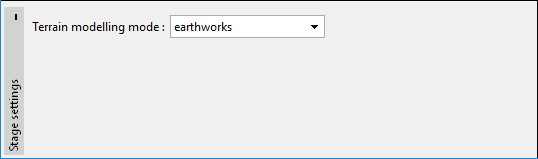
In this mode, we model the terrain changes using earthworks.