Definition of Construction Site using the GPS
If we don´t know the coordinates of the construction site, but we know the area of our interest, it is recommended to obtain coordinates as follows:
Open e.g. Google Maps in the web browser and find a middle of the required area. Using the right mouse button we display the contextual menu and copy the coordinates using the left mouse button.
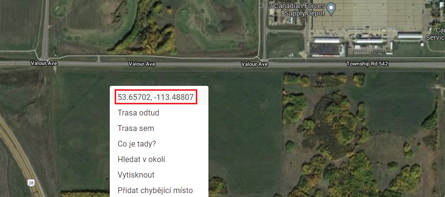 Maps
Maps
In the program (in the "Construction Site" frame), we select a "Rectangle (GPS)" option. Using the button on the right from the "GPS coordinates of center and construction site dimensions" description, we paste the coordinates from the clipboard. Finally, we define the dimensions of the construction site (Δx, Δy).
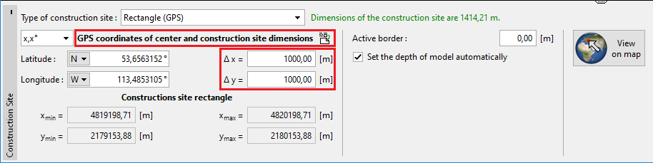 Frame "Construction Site"
Entered GPS coordinates are transformed to the local coordinates x y using the defined coordinate system. We can check the defined construction site using the "View on map" button. In case, the GPS point is out of range of the defined coordinate system, the construction site will be displayed out of this area. In this case, it is necessary to define the correct coordinate system.
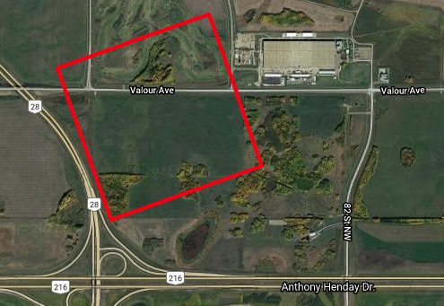 Defined construction site
Available map sources and points of interest (e.g. from the database of historical boreholes) can be loaded in the "Source Data" frame.