Modification of the Final 3D Model Using Boreholes
A correctly created model corresponds not only to defined Geological sections and Soil profiles, but it must also meet our ideas about the stratigraphy of the model.
The best way of the final model check is to create a sufficient number of output sections (or visualization of model sides).
The final model can be easily edited by adding of new boreholes and changing their layers thicknesses. We see a too thick layer of "Made Ground" in the middle of the model.
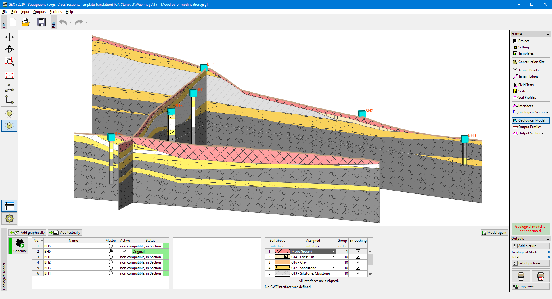 Model before correction
We add a new borehole and change the thicknesses of layers according to our ideas.
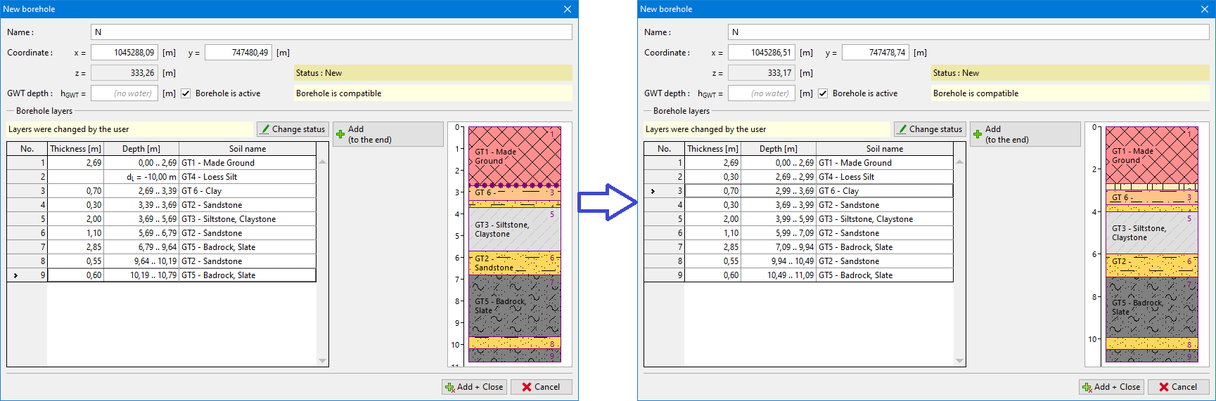 Borehole before and after changes
Then we generate a model and consider the accuracy of modification.
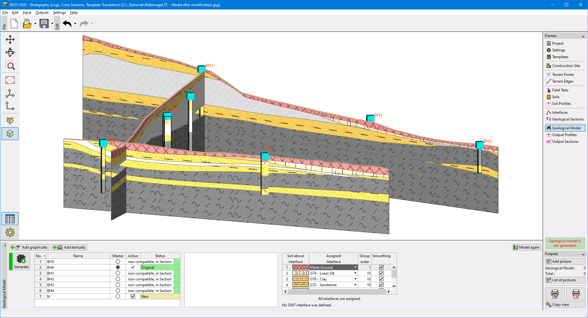 Model after correction